Page Contributor(s): Bryant Robbins, Palmer, AK, USA.
INTRO
This 2.8 mile bike climb is located in Comanche County, Oklahoma, USA. The average gradient is 6.9% and there is a total elevation gain of 1,008 ft, finishing at 2,444 ft.
Use the profile tool, route map, and weather forecast to conquer this cycling climb.
See more details and tools regarding this climb's grade via our interactive Profile Tool.
Information Not Available
If you have any information regarding this climb, we'd like to hear from you. Click the CONTRIBUTE button to share your thoughts with us.
CONTRIBUTE
Information Not Available
If you have any information regarding this climb, we'd like to hear from you. Click the CONTRIBUTE button to share your thoughts with us.
CONTRIBUTE
Information Not Available
If you have any information regarding this climb, we'd like to hear from you. Click the CONTRIBUTE button to share your thoughts with us.
CONTRIBUTE
ROUTE MAP
MEMBER RATING
Not Yet Rated
-
Road
-
Traffic
-
Scenery
SEE REVIEWS
CURRENT WEATHER
FULL FORECAST
NEARBY CLIMBS (0) RADIAL PROXIMITY
10 mi 25 mi 50 mi
FROM
START FINISH
VIEW ON MAP
No Climbs Found
VIEW ON MAP
MEMBER REVIEWS & COMMENTS
Let us know what you thought of this climb. Signup for our FREE membership to write a review or post a comment.
SIGNUP
Already have an account?
LOG IN HERE
ROUTE MAP
PROFILE TOOL
WIDER SCREEN NEEDED TO VIEW THIS TOOL
Route Interaction
Mount Scott
Map of Route
Explore the climbing route with google maps.
Gradient Profile
Move your mouse across the profile below for gradient, elevation and distance information. (Location on profile will also show on map)
More Tools
Select one of the below menu options for additonal interactive gadgets.
Segment Profile
Info
Streetviews
Images
Segment
Gradient
30%
20%
10%
0%
Gradient Profile
Climb Data
S.G. (%)
show
Climb Profile Not Found
CLIMB SUMMARY
Main Summary
Cycling Mt. Scott Roadway
Ride 2.8 miles gaining 1,008’ at 6.9% average grade.
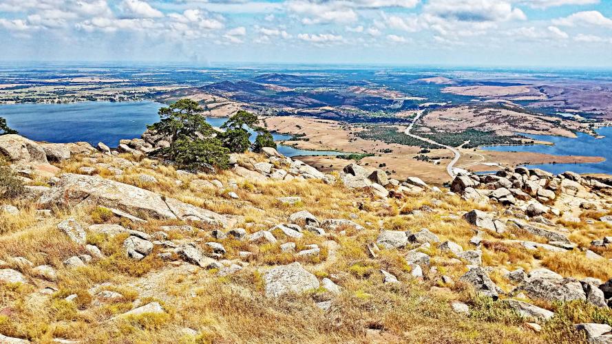
This is a big climb for Oklahoma. We climb to the summit of Mount Scott which rises 2,464’ out of the plains and is in the Wichita National Wildlife Refuge (est. 1901; 59,020 acres) and part of the Wichita Mountains.