29.9
PDI
9.4 mi
DISTANCE
4,069 ft
GAINED
8.2 %
AVG. GRADE
FULL CLIMB STATS
INTRO
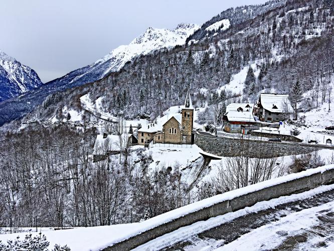
This 9.4 mile bike climb is located in Auvergne-Rhône-Alpes, France. The average gradient is 8.2% and there is a total elevation gain of 4,069 ft, finishing at 6,774 ft.
Use the profile tool, route map, and weather forecast to conquer this cycling climb.
Use the profile tool, route map, and weather forecast to conquer this cycling climb.
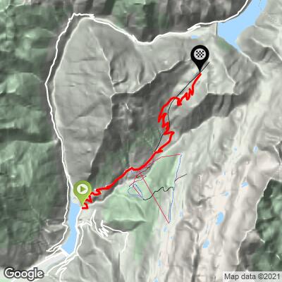
PLAN YOUR ROUTE
See more details and tools regarding this climb's grade via our interactive Profile Tool.
Information Not Available
If you have any information regarding this climb, we'd like to hear from you. Click the CONTRIBUTE button to share your thoughts with us.
Information Not Available
If you have any information regarding this climb, we'd like to hear from you. Click the CONTRIBUTE button to share your thoughts with us.
Before heading out on any cycling adventure check out our Things to Bring on a Cycling Trip and use our interactive check list to ensure you don't forget anything.
Information Not Available
If you have any information regarding this climb, we'd like to hear from you. Click the CONTRIBUTE button to share your thoughts with us.
ROUTE MAP
MEMBER RATING
CURRENT WEATHER
PJAMM TRIPS ADVENTURE STARTER BUNDLES
Check out PJAMM Adventure's prepackaged (self-guided) cycling trips. They will help you plan, document and conquer your next adventure.
NEARBY CLIMBS (0) RADIAL PROXIMITY
FROM No Climbs Found
MEMBER REVIEWS & COMMENTS
Let us know what you thought of this climb. Signup for our FREE membership to write a review or post a comment.
Already have an account?
LOG IN HERE
carlinguernsey
In my opinion, this is one of the hardest climbs in the French Alps - longer and gradient nearly as challenging as the Col du Granon. It is a lesser known and more remote climb in the Oisans area. After Vaujany, the road narrows and gets much more rugged. Fortunately, there is not much traffic in the upper part. If you walk past the end of the parking area at the top, you get a great view of the Lac du Grand Maison and the road up to the Col de la Croix de Fer.