Aufderheide Scenic Byway South Bike Climb - PJAMM Cycling

2.3
FIETS
31.4 mi
DISTANCE
2,795 ft
GAINED
1.5 %
AVG. GRADE

FULL CLIMB STATS

Page Contributor(s): Steve Jones, Olympia, WA, USA

INTRO

This 31.4 mile bike climb is located in OR, USA. The average gradient is 1.5% and there is a total elevation gain of 2,795 ft, finishing at 7,037 ft.

Use the profile tool, route map, and weather forecast to conquer this cycling climb.

See more details and tools regarding this climb's grade via our interactive Profile Tool.
Information Not Available

If you have any information regarding this climb, we'd like to hear from you. Click the CONTRIBUTE button to share your thoughts with us.

Information Not Available

If you have any information regarding this climb, we'd like to hear from you. Click the CONTRIBUTE button to share your thoughts with us.

Before heading out on any cycling adventure check out our Things to Bring on a Cycling Trip and use our interactive check list to ensure you don't forget anything.
Information Not Available

If you have any information regarding this climb, we'd like to hear from you. Click the CONTRIBUTE button to share your thoughts with us.

ROUTE MAP

MEMBER RATING

Not Yet Rated
-
Road
-
Traffic
-
Scenery

CURRENT WEATHER

PJAMM TRIPS ADVENTURE STARTER BUNDLES

Check out PJAMM Adventure's prepackaged (self-guided) cycling trips. They will help you plan, document and conquer your next adventure.
ALL TRIPS
Browse all of our prepackaged trips and find your next adventure!
Crater Lake
United States (OR)
10 ROUTES
29 POIs
ROUTE STATS (TOTAL)
258.3
mi
DISTANCE
29,750
ft
ELEV. GAIN

NEARBY CLIMBS (0) RADIAL PROXIMITY

FROM
No Climbs Found

MEMBER REVIEWS & COMMENTS

Let us know what you thought of this climb. Signup for our FREE membership to write a review or post a comment.
Already have an account?
ROUTE MAP
PROFILE TOOL
Route Data
S.G. (%)
hide
Segment Data
hide

Climb Profile Not Found
CLIMB SUMMARY

Cycling Audeerheide Scenic Byway South

Ride 31 miles gaining 2,832’ at 1.6% average grade (2.3% climb only).

The Aufderheide Scenic Byway (Forest Road 19) connects Rainbow OR (1,209 ft., on the McKenzie River) with mountain-bike mecca Oakridge OR (also 1,209 ft., on the Willamette River), crossing a 3,620-foot divide at the rustic Box Canyon Forest Service facility.

The south side of the climb, while not quite as scenic as the north side, starts in the small community of Westfir, near Oakridge OR.  From Westfir, take Aufderheide Drive north 32 miles to the top of the ridge at Box Canyon.

Very thickly forested route - we are often surrounded and covered by forest.

Constitution Grove is at mile 26.7

Owl as seen in trees at mile 28.5

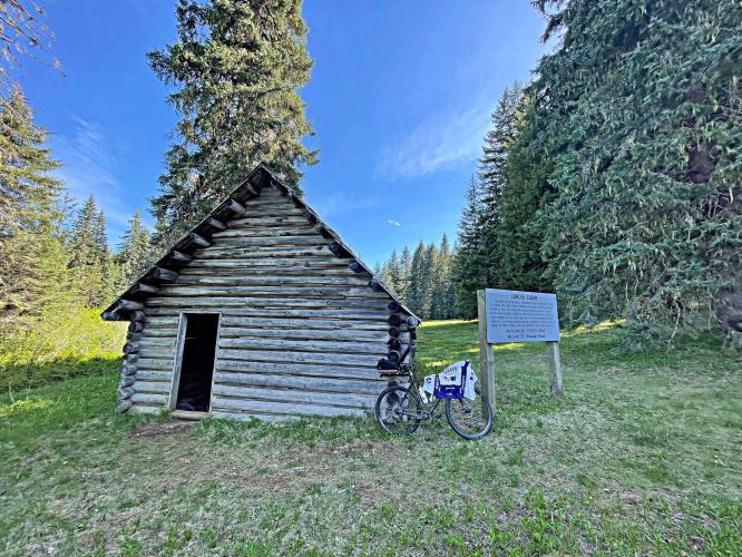
Landis Cabin - on the right about 6/10’s of a mile from finish.