![]()
Cycling Old Yosemite Road
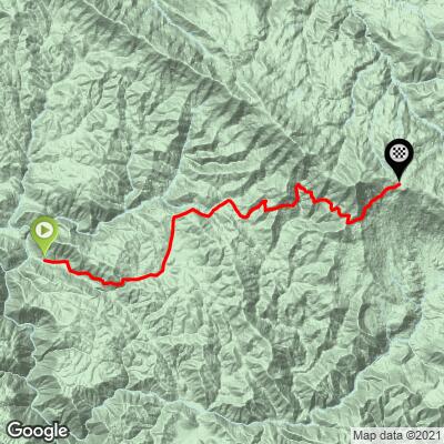
Ride 9.8 miles gaining 2,942’ at 5.5% average grade.
Climb summary by ultra athlete and adventurer John Berude, Berkeley, CA.
![]()
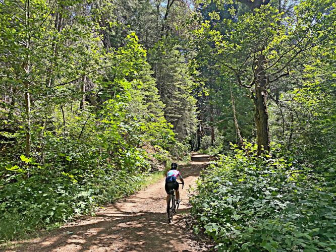
Old Yosemite Road (or Old Coulterville Road) was originally constructed as the scenic route for stagecoaches of tourists destined for Yosemite Valley. The road was built to compete with Big Oak Flat Road (now CA-120), but is now an all-but-forgotten gravel byway that remains as magnificently scenic as when it was opened for travel in June 1874! The climb itself is a generally pleasant affair through oak and pine forests with some sustained brutish and loose sections mixed in. The road affords good views of the surrounding hills and peekaboo views of Pilot Peak, but the real reward comes as you near the top and are treated to an airy, open traverse with expansive views to the south! From the top of the climb you also get a stunning view of the Sierra Crest and the flowing granite of the Emigrant Wilderness/northern Yosemite area. If you're feeling strong, continue climbing a few hundred more feet to the fire lookout on Pilot Peak for the full panoramic experience! While this climb is a good ride in its own right, it's what's beyond the climb that you come for... a long, mellow, and spectacular traverse along the ridge/hillside with sweeping views to the south and east!
![]()
![]()
While it's certainly possible to do the climb and traverse as an out-and-back, it can be combined with the Burma Grade/Bull Creek climb (see separate page for details) to make a loop into Yosemite Valley for the full adventure experience! From the top of the climb, the road continues to traverse the hillside past the turn off for Turnbull Peak (another good out-and-back addition that overlooks the Merced River Canyon) and down to the town of Foresta inside Yosemite National Park. While the road surface is never terrible, it does progressively decline in quality as you approach Foresta from the Turnbull junction. From Foresta, you can join the pavement and ride up to the junction with CA-120/Big Oak Flat Rd for a spectacular high-speed descent into Yosemite Valley. At the bottom, you can either turn right and return to Briceburg via CA-140 (a ripping descent and a gorge-ous ride through the Merced River Canyon) or add on a loop of Yosemite Valley/Mirror Lake/Tunnel View (highly recommended! you're not going to make it all the way here just to skip the iconic part are you?).
![]()
Aerial view of Yosemite Valley (El Capitan + Half Dome) from just past Tunnel View
![]()
Cycling Yosemite - it does not get ANY better than this!!
For those looking for a more "pure" gravel experience, you can alternatively descend directly from Foresta to El Portal on the old Foresta road. Originally maintained as a fire escape route for the town of Foresta, a bridge washout officially decommissioned the road some time ago. As a result, the road surface is generally eroded, the brush is overgrown, one of the bridge crossings requires walking across a few 2x4s nailed together with a handline, a few bouldery hike-a-bike sections, intermittent overgrown poison oak, and apparently the rattlesnakes can be terrible on warmer days... though in keeping with the theme of the ride, the scenery is nothing short of incredible the whole way down and the road cuts a very aesthetic line across the hillside as you descend to the Merced River! All of these factors combine to ensure an epic and memorable finish to the gravel portion of the loop for the adventurous at heart and the robust in practice.