![Kyle Canyon - Hwy 157 Cycling Kyle Canyon - Hwy 157 to Mt. Charleston - cyclist riding]()
Cycling Hwy 157 (Kyle Canyon and Mt. Charleston)
#70 on the Top US Bike Climb List
21.2 miles gaining 5,070’ to 7,847’ at 4.5% average grade.
![Kyle Canyon - John Johnson John Johnson PJAMM Cycling with bike on Kyle Canyon Hwy 157 Mt Charleston bike climb.]()
PJAMM at on Kyle Canyon - 1st of 4 climbs that day.
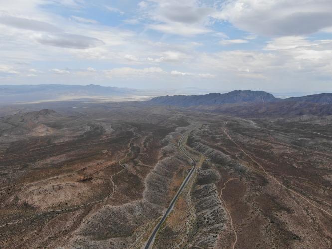
The first 9 miles of the Mt. Charleston/Kyle Canyon climb are in a somewhat bleak high desert environment.
![Cycling up Kyle Canyon Cyclist riding bike up Kyle Canyon, Hwy 157, to Mt. Charleston.]()
At around 9 miles we begin to enter a canyon-like setting with more scenic views.
![Kyle Canyon Elevation sign on Kyle Canyon]()
![Hwy 157 to Mt. Charleston Cyclist riding bike in Mount Charleston Wilderness Area.]()
Just past Echo Way on way to Mt. Charleston Lodge.
We enter Spring Mountain National Recreation Area at mile 12.2 and reach the turnoff to the #49 Hwy 157-158 climb at mile 17.5 (3,986' climbed at 4.6% average grade to that point), but continue straight on Hwy 157.
Mt. Charleston is within the Mount Charleston Wilderness. Mount Charleston Wilderness area is within the Spring Mountains National Recreation Area of the Humboldt-Toiyabe National Forest.
![Bruce Hamilton and Stacy Topping Cyclists at Mt. Charleston Resort.]()
Finish - Mt. Charleston Lodge
This climb can be extremely hot and probably should be avoided between June and August when the average temperatures range from 99 to 104.
If Mt. Charleston Lodge is open, you can get provisions there - restaurant and general store).
This climb can be done in conjunction with 3 other climbs in the immediate area (#24 Hwy 156 which shares its first 14 miles with #34 Hwy 156/158 climb, and Hwy #49 Hwy 157-158, which shares its first 17.5 miles with this Mt. Charleston climb). Be cautious if doing this ride without support as the only provisions are likely to be at the Mt Charleston Lodge at the end of Hwy 157 - support is highly recommended for any effort involving Lee and Kyle Canyons in the same ride. Undertaking these 4 climbs in one day is about 90 miles of riding and 12,000' of climbing, but you can actually fly into Las Vegas very early and get er done that day, if you really want to punish yourself!
You will get a very good sense of the climb viewing our YouTube video.
Traffic and Roadway report: As of October, 2014, the roadway surface was excellent throughout this ride. There is a designated shoulder area on both sides of the roadway from the beginning of the climb to the 158 turn off at mile 17.5 For much of the first half of the ride, traffic can whiz by at highway speeds. Traffic for the last 4 miles on Hwy 157 is very light.
![]()
Steepest ¼ mile begins at mile 20.4 (8.9%) and mile at 19.9 (7.2%)

 We've partnered with Sherpa-Map.com to bring you the best route planning tool. With a PRO Membership you can use this climb as a reference when creating your route.


