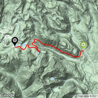
14.6
PDI
21.1 mi
DISTANCE
3,791 ft
GAINED
2.8 %
AVG. GRADE
FULL CLIMB STATS
Page Contributor(s): Steve Jones and Dennis Peck, Olympia, WA, USA; James Wallish, Seattle WA
INTRO
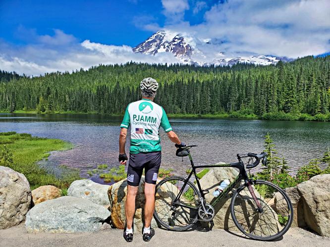
The road is immaculate and the scenery is breathtaking. Definitely one of the best climbs in Washington.
PLAN YOUR ROUTE
See more details and tools regarding this climb's grade via our interactive Profile Tool.
Information Not Available
If you have any information regarding this climb, we'd like to hear from you. Click the CONTRIBUTE button to share your thoughts with us.
Information Not Available
If you have any information regarding this climb, we'd like to hear from you. Click the CONTRIBUTE button to share your thoughts with us.
Before heading out on any cycling adventure check out our Things to Bring on a Cycling Trip and use our interactive check list to ensure you don't forget anything.
Information Not Available
If you have any information regarding this climb, we'd like to hear from you. Click the CONTRIBUTE button to share your thoughts with us.
ROUTE MAP
MEMBER RATING
CURRENT WEATHER
PJAMM TRIPS ADVENTURE STARTER BUNDLES
Check out PJAMM Adventure's prepackaged (self-guided) cycling trips. They will help you plan, document and conquer your next adventure.
NEARBY CLIMBS (0) RADIAL PROXIMITY
FROM No Climbs Found
MEMBER REVIEWS & COMMENTS
Let us know what you thought of this climb. Signup for our FREE membership to write a review or post a comment.
Already have an account?
LOG IN HERE
Jameswallish


If you start this climb at the park entrance and continue to Paradise your total round trip elevation is just shy of 5,000 feet.
The road is immaculate with much less traffic than the Longmire side and the scenery is breathtaking. Watch your decent as the grates can be a little jarring at speed.
Definitely one of the best climbs in Washington!
JohnJohnson
Thanks much for the input James - we adjusted the route start per your input.