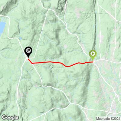
4.3
PDI
4 mi
DISTANCE
948 ft
GAINED
4.2 %
AVG. GRADE
FULL CLIMB STATS
Page Contributor(s): John Summerson, The Complete Guide to Climbing (by Bike) in the Northeast; Dan Razum, San Jose, CA
INTRO
Morrison Hill is part of the annual Tokeneke Classic Road Race. The descent is one of the best around - smooth, fast and wonderfully serpentine.
PLAN YOUR ROUTE
See more details and tools regarding this climb's grade via our interactive Profile Tool.
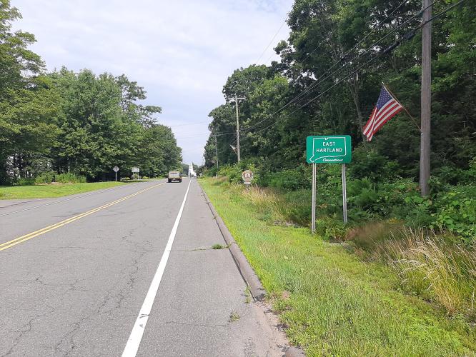
Parking: > You can park at Berg Field in East Hartland, located at the intersection of Mountain Road and Route 20. Head west along Route 20, descending down North Hollow, then climbing Morrison Hill. Descend Morrison Hill and climb back up North Hollow back to Berg Field. As an alternative, you can park at the low point between the 2 climbs. Parking is obvious and used for trail access for hiking and biking.
Information Not Available
If you have any information regarding this climb, we'd like to hear from you. Click the CONTRIBUTE button to share your thoughts with us.
Before heading out on any cycling adventure check out our Things to Bring on a Cycling Trip and use our interactive check list to ensure you don't forget anything.
Information Not Available
If you have any information regarding this climb, we'd like to hear from you. Click the CONTRIBUTE button to share your thoughts with us.
ROUTE MAP
MEMBER RATING
CURRENT WEATHER
PJAMM TRIPS ADVENTURE STARTER BUNDLES
Check out PJAMM Adventure's prepackaged (self-guided) cycling trips. They will help you plan, document and conquer your next adventure.
NEARBY CLIMBS (0) RADIAL PROXIMITY
FROM No Climbs Found
MEMBER REVIEWS & COMMENTS
Let us know what you thought of this climb. Signup for our FREE membership to write a review or post a comment.
Already have an account?
LOG IN HERE
farmano
The climb is quite steep from the start. The grade is moderate after that. At the 1/2 way mark the view towards Springfield MA. is outstanding.The climb finishes with an increased grade for 1/4 mile or so and ends at Berg Field in Hartland. The photo from this page is actually on Lost Acres Road, which is just north of Mountain Road. The building is part of the Lost Acres Vineyard, a great place to stop and visit.