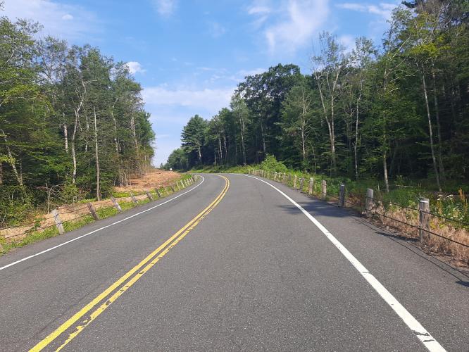
Morrison Hill Road Bike Climb - PJAMM Cycling

1
FIETS
3.4 mi
DISTANCE
824 ft
GAINED
4.2 %
AVG. GRADE

FULL CLIMB STATS

Page Contributor(s): John Summerson, The Complete Guide to Climbing (by Bike) in the Northeast; (Cover photo) Eladio Marquez, Google

INTRO

This 3.4 mile bike climb is located in CT, USA. The average gradient is 4.2% and there is a total elevation gain of 824 ft, finishing at 1,342 ft.

Use the profile tool, route map, and weather forecast to conquer this cycling climb.

See more details and tools regarding this climb's grade via our interactive Profile Tool.
Information Not Available

If you have any information regarding this climb, we'd like to hear from you. Click the CONTRIBUTE button to share your thoughts with us.

Information Not Available

If you have any information regarding this climb, we'd like to hear from you. Click the CONTRIBUTE button to share your thoughts with us.

Before heading out on any cycling adventure check out our Things to Bring on a Cycling Trip and use our interactive check list to ensure you don't forget anything.
Information Not Available

If you have any information regarding this climb, we'd like to hear from you. Click the CONTRIBUTE button to share your thoughts with us.

ROUTE MAP

MEMBER RATING

Difficulty: Moderate
5
Road
5
Traffic
4
Scenery

CURRENT WEATHER

PJAMM TRIPS ADVENTURE STARTER BUNDLES

Check out PJAMM Adventure's prepackaged (self-guided) cycling trips. They will help you plan, document and conquer your next adventure.
ALL TRIPS
Browse all of our prepackaged trips and find your next adventure!
Northeast Fall Colors
United States (MA,ME,NH,NY,VT)
24 ROUTES
37 POIs
ROUTE STATS (TOTAL)
98
mi
DISTANCE
35,116
ft
ELEV. GAIN

NEARBY CLIMBS (0) RADIAL PROXIMITY

FROM
No Climbs Found

MEMBER REVIEWS & COMMENTS

Let us know what you thought of this climb. Signup for our FREE membership to write a review or post a comment.
Already have an account?

Mar 19, 2021
difficulty: Moderate
scenery: 4
traffic: 5
road: 5
Mar 19, 2021
scenery: 4
traffic: 5
road: 5
Beautiful area with low traffic. The start of the climb is a bit steep and continues on for a while. With the correct gearing it's moderate. If you are in a 36/25, you are standing on the pedals. See a great view on your left of the Barkhamsted Reservoir. Note the rocky cliffs on your right. The route levels out a bit, but finishes with a final climb. You are in the middle of the Tunxis forest for most of the ride. And you won't see a single house for the entire ride.
ROUTE MAP
PROFILE TOOL

Climb Profile Not Found
CLIMB SUMMARY

Cycling Morrison Hill Road, Connecticut - sign for Granville State Forest

Cycling Morrison Hill Road, Connecticut

Photo: Sign for Granville State Forest

(New England Nomad)

“…Morrison Hill Road also heads up the ridge under thick tree cover and over a mostly moderate grade.  Soon it becomes stair step as you gain altitude.  The road makes a right and then a left turn on the way up.  Near the top you pop out of the trees and pass the entrance to the Granville State Forest on the right and the listed climb ends soon after as the grade flattens out.” (This quote is provided with the approval of John Summerson from his book, The Complete Guide to Climbing (by Bike) in the Northeast, pg. 55.)

Access to full Climb Summary requires a PJAMM Cycling PRO Membership!

It takes less than a minute to sign up & with your PRO membership you can:
  • Rate climbs, post comments and share your experiences on any of our climb pages
  • Create bucket lists of climbs & mark the dates you complete them
  • Weather data for all climbs - Start & Finish
  • Upload photos to your member page to customize your PJAMM Cycling experience
  • Utilize all of our interactive tools - Profile & Routes in Area
  • Download climb route .gpx files
LEARN MORE
SIGN UP

Already have an account? LOG IN HERE