![]()
Cycling Warren Hill Road West
Ride 2.2 miles gaining 785’ at 6.8% average grade.
![]()
Start of climb.
John Summerson summary:
“The west side of Warren Hill Road is a stout climb along Route 45 that carries some traffic at times. The road has a small shoulder for riding however. The grade is solid to start and then becomes stair step for the remainder of the ascent. Near the top the grade eases and the listed climb ends at Flat Rocks Road on the left. Due to its straight routing and average grade, Warren Hill Road West is a quick descent as well.” (This quote is provided with the approval of John Summerson from his book, The Complete Guide to Climbing (by Bike) in the Northeast, pg. 59.)
Climb summary by PJAMM ambassador, Dan Razum.
There are actually two "starting points" on this climb. There is a little triangle area where Rte 45 meets Rte 7, resulting in 2 intersections of Rte 45 and Rte 7, separated by a couple hundred yards. So you can start at either junction, it doesn't really matter, they both come together in a few hundred yards to become a single road going up the mountain.
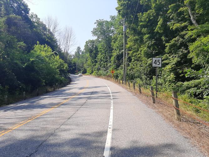
Rte 45 is a main road, compared to the other nearby roads that go up from Rte 7. As such, it has significantly more traffic than other climbs in the area. However, the traffic is still pretty moderate. But you will see cars on this climb whereas on some of the other climbs you may not see any cars at all. There is a decent shoulder, the pavement is in good condition and the road is mostly straight, providing good sight lines. So even though there was some traffic when we climbed, it really wasn't a concern.
![]()
The gradient is pretty constant throughout the climb, other than a short flattish section near the middle. So you can find a climbing rhythm and pretty much maintain it for the whole climb. We ride through a thick forest but because the road is wider there are some areas where there isn't a lot of shade.
![]()
Finish

 We've partnered with Sherpa-Map.com to bring you the best route planning tool. With a PRO Membership you can use this climb as a reference when creating your route.

