![]()
Cycling Castle Craig
Ride 1.2 miles gaining 512’ at 8.2% average grade.
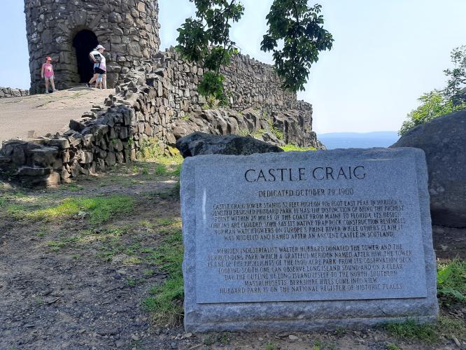
Castle Craig is the eighth most difficult road bike climb in Connecticut. Castle Craig is a prominent landmark and a popular tourist attraction located in Hubbard Park, which is situated in the city of Meriden, Connecticut. This unique structure is perched atop East Peak in the Hanging Hills, offering stunning panoramic views of the surrounding area.
“The climb to Castle Craig may be the most challenging in the Bristol/Meriden area of Connecticut. In thick woods for almost the entire ascent, you head east over solid grade to begin which gradually steepens up to a junction on the left and the slope eases. Keep straight here to soon find more challenging pedaling. Just before climb’s end you find the maximum grade on the hill which is just before a small parking area at the end of the road. If you turn left at the junction, you have 0.4 miles of up and down pedaling to the actual Castle Craig. Stats for this version of the hill are the identical distance at 7.1% average grade.” (This quote is provided with the approval of John Summerson from his book, The Complete Guide to Climbing (by Bike) in the Northeast, pg. 63.)
![]()
Start of the climb.
Climb summary by PJAMM ambassador Dan Razum.
The climb starts on Peak Drive after a pleasant ride on Park Drive along the Merimere Reservoir. When we did the climb there was a gate on Park Dr, just north of Peak Dr, which prevented auto access to Peak Dr from the north, from Rt 71. So to access Castle Craig by car you need to go via Main St, south of Rte 691. By bike, however, there is no problem to access from either direction, the gate is easily bypassed on a bicycle.
There are lots of trees lining the road so plenty of shade on this climb. The road is moderately wide, with no markings or shoulders, but traffic is light and courteous so it's not a concern. The road surface occasionally has some cracks but overall it's in good condition.
![]()
The gradient kicks up fairly steep from the start of the climb and starts easing about halfway through. Near the top there is a fork in the road. After bearing left we climb a little bit more and arrive at a large parking lot in front of Castle Craig.
![]()
There are very nice vistas of the surrounding land, especially if you walk to the top of Castle Craig, which is open to the public. Castle Craig was built between 1900 and 1901. It was designed by architect Walter P. Crabtree and financed by businessman and philanthropist Walter Hubbard, who donated the parkland and funds for the castle's construction to the city of Meriden.
![]()
View from the top.
The castle is designed in a European-style, with a stone tower that resembles a medieval fortress. It stands at a height of approximately 32 feet and is constructed using trap rock, which is abundant in the Hanging Hills region. The main attraction of Castle Craig is its observation deck, which is accessible via a winding staircase inside the tower. From the observation deck, visitors can enjoy breathtaking panoramic views of Meriden and the surrounding towns, as well as distant views of Long Island Sound.
![]()

 We've partnered with Sherpa-Map.com to bring you the best route planning tool. With a PRO Membership you can use this climb as a reference when creating your route.

