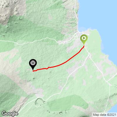
25.2
PDI
18.3 mi
DISTANCE
4,911 ft
GAINED
5.1 %
AVG. GRADE
FULL CLIMB STATS
INTRO
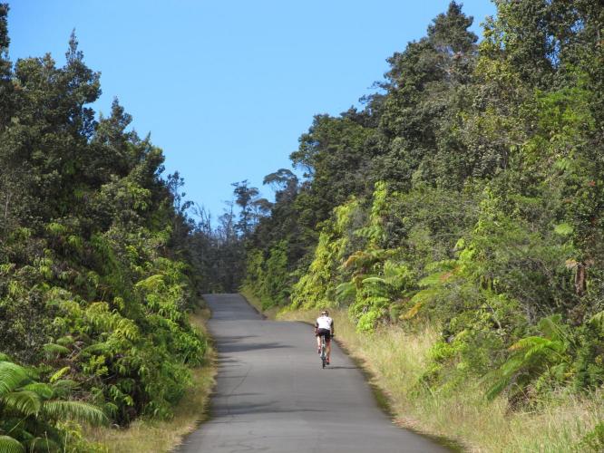
Note: No Trespassing sign at mile 16. This ride is just south of Hilo, the capital of the State of Hawaii and one of the wettest cities in the U.S. (average rainfall of 126" and rainfall approximately 75% of the days throughout the year). The view during this climb is fairly consistent: lush jungle setting from start to finish (seen in our climb's YouTube video).
"Stainback Road is a good warm-up for the giant climbs on the Big Island. Shallow to start, eventually you reach fairly steady grade. The route is moderate climbing over poor pavement at times and through Hawaiian jungle in places. The lower end of the road carries a bit of traffic on it at times and the ascent ends near the Big Island's prison (road dead ends)." (Quote presented with the approval of John Summerson from The Complete Guide to Climbing (by Bike), 2nd Ed., p 180.)
PLAN YOUR ROUTE
See more details and tools regarding this climb's grade via our interactive Profile Tool.
Information Not Available
If you have any information regarding this climb, we'd like to hear from you. Click the CONTRIBUTE button to share your thoughts with us.
Information Not Available
If you have any information regarding this climb, we'd like to hear from you. Click the CONTRIBUTE button to share your thoughts with us.
Before heading out on any cycling adventure check out our Things to Bring on a Cycling Trip and use our interactive check list to ensure you don't forget anything.
Information Not Available
If you have any information regarding this climb, we'd like to hear from you. Click the CONTRIBUTE button to share your thoughts with us.
ROUTE MAP
MEMBER RATING
CURRENT WEATHER
PJAMM TRIPS ADVENTURE STARTER BUNDLES
Check out PJAMM Adventure's prepackaged (self-guided) cycling trips. They will help you plan, document and conquer your next adventure.
NEARBY CLIMBS (0) RADIAL PROXIMITY
FROM No Climbs Found
MEMBER REVIEWS & COMMENTS
Let us know what you thought of this climb. Signup for our FREE membership to write a review or post a comment.
Already have an account?
LOG IN HERE
poxpower

This climb shouldn't be on any list, there's many of these signs way before mile 16. Trespassing here is a crime apparently.