11.4
PDI
3.7 mi
DISTANCE
1,618 ft
GAINED
7.9 %
AVG. GRADE
FULL CLIMB STATS
Page Contributor(s): Dan Razum, San Jose, CA
INTRO
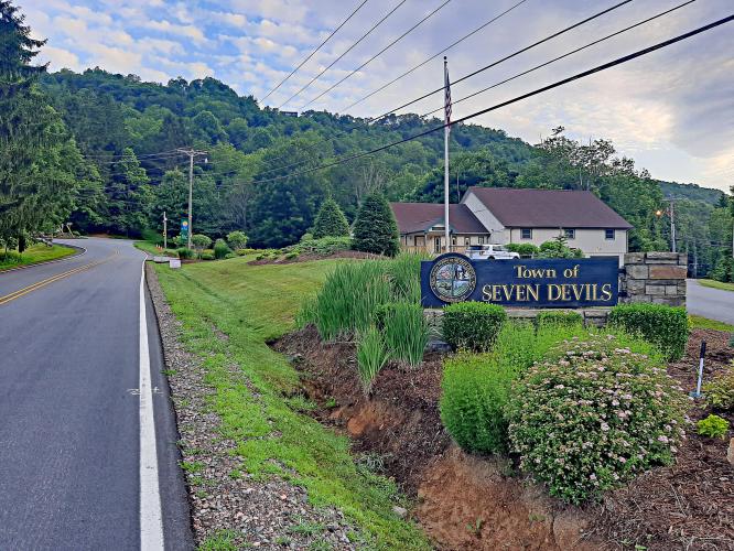
This 3.7 mile bike climb is located in NC, USA. The average gradient is 7.9% and there is a total elevation gain of 1,618 ft, finishing at 4,760 ft.
Use the profile tool, route map, and weather forecast to conquer this cycling climb.
Use the profile tool, route map, and weather forecast to conquer this cycling climb.
PLAN YOUR ROUTE
See more details and tools regarding this climb's grade via our interactive Profile Tool.
Information Not Available
If you have any information regarding this climb, we'd like to hear from you. Click the CONTRIBUTE button to share your thoughts with us.
Information Not Available
If you have any information regarding this climb, we'd like to hear from you. Click the CONTRIBUTE button to share your thoughts with us.
Before heading out on any cycling adventure check out our Things to Bring on a Cycling Trip and use our interactive check list to ensure you don't forget anything.
Information Not Available
If you have any information regarding this climb, we'd like to hear from you. Click the CONTRIBUTE button to share your thoughts with us.
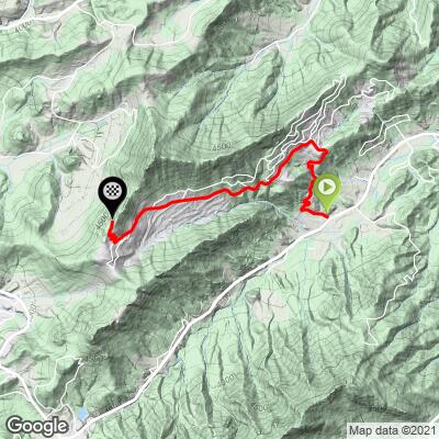
ROUTE MAP
MEMBER RATING
CURRENT WEATHER
PJAMM TRIPS ADVENTURE STARTER BUNDLES
Check out PJAMM Adventure's prepackaged (self-guided) cycling trips. They will help you plan, document and conquer your next adventure.
NEARBY CLIMBS (0) RADIAL PROXIMITY
FROM No Climbs Found
MEMBER REVIEWS & COMMENTS
Let us know what you thought of this climb. Signup for our FREE membership to write a review or post a comment.
Already have an account?
LOG IN HERE
HSPaxton

Great location for a quick ride as I'm in the area for the annual Highland Games. Ample parking at the base. Friendly folks along the route. Steep but short sections, a couple of fun switchbacks, great views of the backside of the hill once you are on top.
jsummers
If you are looking for variable grade this is a good choice. It begins through switchbacks over solid grade. Pedaling then gets quite easy as you head west towards the ski area. You then enter a section of mountain homes with a few tight turns and severe grade in places.