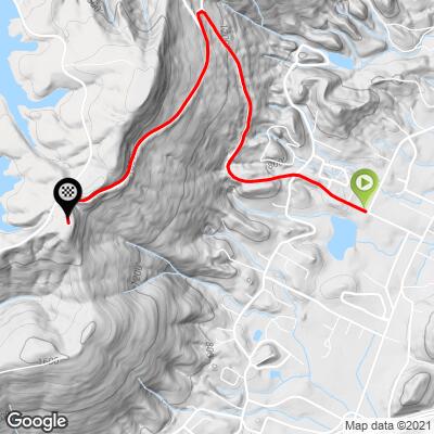
6.4
PDI
2.8 mi
DISTANCE
1,033 ft
GAINED
6.9 %
AVG. GRADE
FULL CLIMB STATS
Page Contributor(s): Eric Kuehl, Chicago, IL, USA; Todd Short, Scottsdale, AZ, USA
INTRO
This 2.8 mile bike climb is located in TN, USA. The average gradient is 6.9% and there is a total elevation gain of 1,033 ft, finishing at 1,888 ft.
Use the profile tool, route map, and weather forecast to conquer this cycling climb.
Use the profile tool, route map, and weather forecast to conquer this cycling climb.
PLAN YOUR ROUTE
See more details and tools regarding this climb's grade via our interactive Profile Tool.
Information Not Available
If you have any information regarding this climb, we'd like to hear from you. Click the CONTRIBUTE button to share your thoughts with us.
Information Not Available
If you have any information regarding this climb, we'd like to hear from you. Click the CONTRIBUTE button to share your thoughts with us.
Before heading out on any cycling adventure check out our Things to Bring on a Cycling Trip and use our interactive check list to ensure you don't forget anything.
Information Not Available
If you have any information regarding this climb, we'd like to hear from you. Click the CONTRIBUTE button to share your thoughts with us.
ROUTE MAP
MEMBER RATING
CURRENT WEATHER
PJAMM TRIPS ADVENTURE STARTER BUNDLES
Check out PJAMM Adventure's prepackaged (self-guided) cycling trips. They will help you plan, document and conquer your next adventure.
NEARBY CLIMBS (0) RADIAL PROXIMITY
FROM No Climbs Found
MEMBER REVIEWS & COMMENTS
Let us know what you thought of this climb. Signup for our FREE membership to write a review or post a comment.
Already have an account?
LOG IN HERE
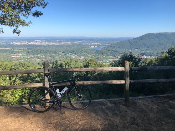
Bootsc
I was a little out of shape when I made this climb so it hurt. There are some steeeeep sections but if you're reading this you most likely enjoy the challenge and like to climb so old hat, right? At the top hang a left and take in the great view of Lookout Mt., the Tennessee River, and the city of Chattanooga. The 5 mile loop at the top is good fun with excellent views. The top half the decent is really fast and smooth, but the second half of the decent is also really fast but basically outside of the park (instead a town/county road) and so not nearly as smooth with some terrible road patches and potholes. Be careful. I'd like to say if I made this climb now I would rate it's difficulty at Challenging instead of Strenuous because its not very long but I could be wrong. Enjoy!