20.5
PDI
17.8 mi
DISTANCE
4,191 ft
GAINED
3.6 %
AVG. GRADE
FULL CLIMB STATS
Page Contributor(s): Phillip Richards, CO
INTRO
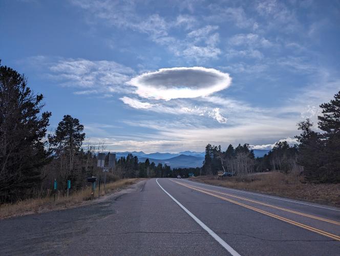
This 17.8 mile bike climb is located in CO, USA. The average gradient is 3.6% and there is a total elevation gain of 4,191 ft, finishing at 9,335 ft.
Use the profile tool, route map, and weather forecast to conquer this cycling climb.
Use the profile tool, route map, and weather forecast to conquer this cycling climb.
PLAN YOUR ROUTE
See more details and tools regarding this climb's grade via our interactive Profile Tool.
Information Not Available
If you have any information regarding this climb, we'd like to hear from you. Click the CONTRIBUTE button to share your thoughts with us.
Information Not Available
If you have any information regarding this climb, we'd like to hear from you. Click the CONTRIBUTE button to share your thoughts with us.
Before heading out on any cycling adventure check out our Things to Bring on a Cycling Trip and use our interactive check list to ensure you don't forget anything.
Information Not Available
If you have any information regarding this climb, we'd like to hear from you. Click the CONTRIBUTE button to share your thoughts with us.
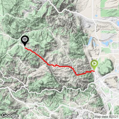
ROUTE MAP
MEMBER RATING
CURRENT WEATHER
PJAMM TRIPS ADVENTURE STARTER BUNDLES
Check out PJAMM Adventure's prepackaged (self-guided) cycling trips. They will help you plan, document and conquer your next adventure.
NEARBY CLIMBS (0) RADIAL PROXIMITY
FROM No Climbs Found
MEMBER REVIEWS & COMMENTS
Let us know what you thought of this climb. Signup for our FREE membership to write a review or post a comment.
Already have an account?
LOG IN HERE
djcov1969
I do NOT take photos by doing one handed pics, my hands stayed steady on the bars PERIOD! Once I put my foot down, that is where I call my ride official over and must turn around. But my goodness this was hard. I only made it to the valley break point where it goes down hill a little over a mile @ 6.5 miles up, I went half a mile down and said NO... go back you're not ready or fully trained! The ride down is dangerous and fast if you let it. No shoulder, cars whizzing by, and deep gulley's you can fall into on the side of the road. I'll be back on Thursday LOL I will too, scary stuff but a heck of a ride and scenery is nuts breath taking GO DO IT!
standard141
Good ride up and down. Def forces you to keep the pressure on. Had a blast flying down too!
djcov1969
I am going on Monday (in two days) so thank you for the very very recent info