Cucharas Pass North Bike Climb - PJAMM Cycling

13.2
PDI
15.9 mi
DISTANCE
2,823 ft
GAINED
3.3 %
AVG. GRADE

FULL CLIMB STATS

Page Contributor(s): Julia Woods, CO

INTRO

This 15.9 mile bike climb is located in CO, USA. The average gradient is 3.3% and there is a total elevation gain of 2,823 ft, finishing at 9,936 ft.

Use the profile tool, route map, and weather forecast to conquer this cycling climb.

See more details and tools regarding this climb's grade via our interactive Profile Tool.
Information Not Available

If you have any information regarding this climb, we'd like to hear from you. Click the CONTRIBUTE button to share your thoughts with us.

Information Not Available

If you have any information regarding this climb, we'd like to hear from you. Click the CONTRIBUTE button to share your thoughts with us.

Before heading out on any cycling adventure check out our Things to Bring on a Cycling Trip and use our interactive check list to ensure you don't forget anything.
Information Not Available

If you have any information regarding this climb, we'd like to hear from you. Click the CONTRIBUTE button to share your thoughts with us.

ROUTE MAP

MEMBER RATING

Not Yet Rated
-
Road
-
Traffic
-
Scenery

CURRENT WEATHER

PJAMM TRIPS ADVENTURE STARTER BUNDLES

Check out PJAMM Adventure's prepackaged (self-guided) cycling trips. They will help you plan, document and conquer your next adventure.
ALL TRIPS
Browse all of our prepackaged trips and find your next adventure!
Colorado: Front Range
United States (CO)
20 ROUTES
46 POIs
ROUTE STATS (TOTAL)
563.5
mi
DISTANCE
73,545
ft
ELEV. GAIN
RMNP: Trail Ridge Road
United States (CO)
13 ROUTES
33 POIs
ROUTE STATS (TOTAL)
258.2
mi
DISTANCE
25,530
ft
ELEV. GAIN

NEARBY CLIMBS (0) RADIAL PROXIMITY

FROM
No Climbs Found

MEMBER REVIEWS & COMMENTS

Let us know what you thought of this climb. Signup for our FREE membership to write a review or post a comment.
Already have an account?
ROUTE MAP
PROFILE TOOL
Route Data
S.G. (%)
hide
Segment Data
hide

Climb Profile Not Found
CLIMB SUMMARY

Climb summary by Julia Woods, CO

This spectacular climb starts in the small town of La Veta (this rider highly recommends grabbing a pastry at the Ryus Bakery in town beforehand) and takes you along a sparsely populated highway to the pass.

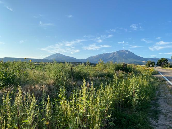
Along the way you will be greeted by diverse scenery including geological dikes, beautiful wildflowers in the summer, old barns, and eventually hairpin turns bobbing and weaving through the aspens.

The grade is quite manageable, and it is the type of ride where there is so much beauty to take in that you forget how hard your legs and lungs are working. Descending down those hairpins is an absolute blast, and the mellow grade afterwards cruises you back into town.

Road was in great condition as of 2021. I recommend going up and over the pass to Monument Lake and biking back up the south side of Cucharas Pass for a memorable half century.