Lizard Head Pass North Bike Climb - PJAMM Cycling

8.7
PDI
11.9 mi
DISTANCE
2,050 ft
GAINED
2.4 %
AVG. GRADE

FULL CLIMB STATS

Page Contributor(s): John Summerson, The Complete Guide to Climbing (by Bike) 2nd Edition; Bruce Hamilton, La Quinta, CA

INTRO

This 11.9 mile bike climb is located in CO, USA. The average gradient is 2.4% and there is a total elevation gain of 2,050 ft, finishing at 9,748 ft.

Use the profile tool, route map, and weather forecast to conquer this cycling climb.

PLAN YOUR ROUTE

We've partnered with Sherpa-Map.com to bring you the best route planning tool. With a PRO Membership you can use this climb as a reference when creating your route.

See more details and tools regarding this climb's grade via our interactive Profile Tool.
Information Not Available

If you have any information regarding this climb, we'd like to hear from you. Click the CONTRIBUTE button to share your thoughts with us.

Information Not Available

If you have any information regarding this climb, we'd like to hear from you. Click the CONTRIBUTE button to share your thoughts with us.

Before heading out on any cycling adventure check out our Things to Bring on a Cycling Trip and use our interactive check list to ensure you don't forget anything.
Information Not Available

If you have any information regarding this climb, we'd like to hear from you. Click the CONTRIBUTE button to share your thoughts with us.

ROUTE MAP

MEMBER RATING

Difficulty: Moderate
4
Road
3
Traffic
5
Scenery

CURRENT WEATHER

PJAMM TRIPS ADVENTURE STARTER BUNDLES

Check out PJAMM Adventure's prepackaged (self-guided) cycling trips. They will help you plan, document and conquer your next adventure.
ALL TRIPS
Browse all of our prepackaged trips and find your next adventure!
Colorado: Front Range
United States (CO)
20 ROUTES
46 POIs
ROUTE STATS (TOTAL)
563.5
mi
DISTANCE
73,545
ft
ELEV. GAIN
RMNP: Trail Ridge Road
United States (CO)
13 ROUTES
33 POIs
ROUTE STATS (TOTAL)
258.2
mi
DISTANCE
25,530
ft
ELEV. GAIN

NEARBY CLIMBS (0) RADIAL PROXIMITY

FROM
No Climbs Found

MEMBER REVIEWS & COMMENTS

Let us know what you thought of this climb. Signup for our FREE membership to write a review or post a comment.
Already have an account?

May 28, 2022
difficulty: Moderate
scenery: 5
traffic: 3
road: 4
May 28, 2022
scenery: 5
traffic: 3
road: 4
Tremendous ride, would highly recommend if you're in the area. Beautiful scenery and fun climbs and drops. Depending on the time of year traffic can be rough since this road leads to Telluride and mountain village, but that's the only detriment.
ROUTE MAP
PROFILE TOOL
Route Data
S.G. (%)
hide
Segment Data
hide
CLIMB SUMMARY

Cycling Lizard Head Pass from the North

Ride 11.9 miles gaining 2,055’ at 2.4% average grade (steepest ¼ mile is 7.8%).

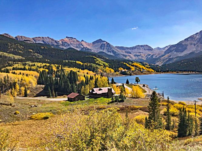
“While not a difficult ascent, the north side of Lizard Head Pass is one of the most spectacular routes in the world.  After its start within some trees you soon come to a meadow and stunning views of peaked mountains.  A Descent follows back into the trees.  Views soon reappear however.  Never steep, the several descents knock down its average grade.  The climb ends at the signed pass at over 10,000 feet.”  This quote is presented with the approval of John Summerson, from his book The Complete Guide to Climbing (by Bike) in Colorado, page 136.

View northeast at mil 5.5

Just beginning a 1.3 mile descent.

View southeast from the northern end of Trout Lake at mile 10.2