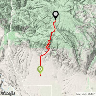
20.3
PDI
10.5 mi
DISTANCE
3,440 ft
GAINED
6.2 %
AVG. GRADE
FULL CLIMB STATS
Page Contributor(s): Stefan Kron, Seattle, WA, USA; Mike McQuaide, Luxemborg; Chris Coddington, Quincy, WA, USA
INTRO
This 10.5 mile bike climb is located in WA, USA. The average gradient is 6.2% and there is a total elevation gain of 3,440 ft, finishing at 5,699 ft.
Use the profile tool, route map, and weather forecast to conquer this cycling climb.
Use the profile tool, route map, and weather forecast to conquer this cycling climb.
PLAN YOUR ROUTE
See more details and tools regarding this climb's grade via our interactive Profile Tool.
Information Not Available
If you have any information regarding this climb, we'd like to hear from you. Click the CONTRIBUTE button to share your thoughts with us.
Information Not Available
If you have any information regarding this climb, we'd like to hear from you. Click the CONTRIBUTE button to share your thoughts with us.
Before heading out on any cycling adventure check out our Things to Bring on a Cycling Trip and use our interactive check list to ensure you don't forget anything.
Information Not Available
If you have any information regarding this climb, we'd like to hear from you. Click the CONTRIBUTE button to share your thoughts with us.
ROUTE MAP
MEMBER RATING
CURRENT WEATHER
PJAMM TRIPS ADVENTURE STARTER BUNDLES
Check out PJAMM Adventure's prepackaged (self-guided) cycling trips. They will help you plan, document and conquer your next adventure.
NEARBY CLIMBS (0) RADIAL PROXIMITY
FROM No Climbs Found
MEMBER REVIEWS & COMMENTS
Let us know what you thought of this climb. Signup for our FREE membership to write a review or post a comment.
Already have an account?
LOG IN HERE
Jameswallish


Need to start in Ellensburg for the full diesel experience. As an added perk the ride through the farmlands is beautiful and a perfect warmup for the climb.
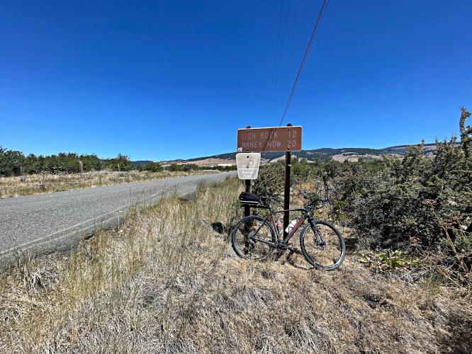
I recommend wide tires (I rode this on my gravel bike with 43mm semi-slicks) glad I did as there is a ton of broken chip seal and the best part of the climb, the summit at Lions Rock is a few miles past the end of the “paved” road and a few hundred feet higher.
This was a great ride and I plan on doing it again!
ReboundMan


I rode this climb a couple of times in 2023 to prepare for L'Etape - from its profile it was the closest thing in Washington to Col de Joux Plane. It was pretty similar, and in the end the temperature profile was pretty good as well!
Beautiful scenery as you go up and work your way through the tree line. Road is similar to European climbs - one lane most of the way and we'll paved with a few washout exceptions. All of the drivers I encountered were uncharacteristically kind and courteous towards a lone biker.
I had to drive here, so would park at the state park down in Ellensburg by the highway and ride up. It's a good effort that way, about 45 miles round trip with just under 4k of total climbing.
erik.lystad


This climb oddly felt similar to some of the European climbs along rural villages, meandering along the hills with minimal traffic. Small narrow road but well paved. At the top is a flat ride along the tree line. It makes for a great workout
athletalatina


Best way to get elevation