Baldwin - Olinda Roads Bike Climb - PJAMM Cycling

23.1
PDI
12.4 mi
DISTANCE
4,038 ft
GAINED
6.2 %
AVG. GRADE

FULL CLIMB STATS

INTRO

This climb shares its first 8 miles with the second highest Fiets Index climb in the US (Haleakala). Baldwin becomes Olinda at about 7 miles up the volcano from the start in Paia. At the 8 mile mark, instead of turning right on Hanamu Rd (for the Haleakala climb), we continue straight on Olinda for another 4.4 miles to the end of the road.

"This climb shares its shallow grade beginning segment with giant Haleakala on Maui. One mile beyond the town of Makewao, continue straight on Olinda instead of turning right on Hanamu. The road continues to climb through forest in places with some steeper sections and dead ends." (This quote is presented with the approval of John Summerson, from his book, The Complete Guide to Climbing (by Bike), 2nd Edition, pg. 176.)

See more details and tools regarding this climb's grade via our interactive Profile Tool.
Information Not Available

If you have any information regarding this climb, we'd like to hear from you. Click the CONTRIBUTE button to share your thoughts with us.

Information Not Available

If you have any information regarding this climb, we'd like to hear from you. Click the CONTRIBUTE button to share your thoughts with us.

Before heading out on any cycling adventure check out our Things to Bring on a Cycling Trip and use our interactive check list to ensure you don't forget anything.
Information Not Available

If you have any information regarding this climb, we'd like to hear from you. Click the CONTRIBUTE button to share your thoughts with us.

ROUTE MAP

MEMBER RATING

Difficulty: Challenging
4
Road
3
Traffic
2
Scenery

CURRENT WEATHER

PJAMM TRIPS ADVENTURE STARTER BUNDLES

Check out PJAMM Adventure's prepackaged (self-guided) cycling trips. They will help you plan, document and conquer your next adventure.
ALL TRIPS
Browse all of our prepackaged trips and find your next adventure!
Hawaii: Haleakala
United States (HI)
14 ROUTES
30 POIs
ROUTE STATS (TOTAL)
191.7
mi
DISTANCE
30,558
ft
ELEV. GAIN
Hawaii: Mauna Kea, Mauna Loa
United States (HI)
11 ROUTES
38 POIs
ROUTE STATS (TOTAL)
300.4
mi
DISTANCE
46,184
ft
ELEV. GAIN
Kauai
United States (HI)
13 ROUTES
10 POIs
ROUTE STATS (TOTAL)
98.3
mi
DISTANCE
24,063
ft
ELEV. GAIN
Oahu
United States (HI)
7 ROUTES
11 POIs
ROUTE STATS (TOTAL)
19.2
mi
DISTANCE
7,073
ft
ELEV. GAIN

NEARBY CLIMBS (0) RADIAL PROXIMITY

FROM
No Climbs Found

MEMBER REVIEWS & COMMENTS

Let us know what you thought of this climb. Signup for our FREE membership to write a review or post a comment.
Already have an account?

Apr 10, 2021
difficulty: Challenging
scenery: 2
traffic: 3
road: 4
Apr 10, 2021
scenery: 2
traffic: 3
road: 4
Another good test on Maui. It really is in two parts - the lower part (Baldwin) is good road with traffic: the upper part after Makawao (Olinda) has much less traffic, it has steeper pitches, and very little traffic. You can park at the beach in Paia.
ROUTE MAP
PROFILE TOOL
Route Data
S.G. (%)
hide
Segment Data
hide

Climb Profile Not Found
CLIMB SUMMARY

IMG_0998.JPG

Start at sea level if you wish.

Cycling Baldwin-Olinda Road - the lower leg of the Haleakala bike climb.

Ride 12.4 miles gaining 4,080’ to elevation 4,046 at 6.2%.

IMG_0998.JPG

Bruce has met his match!

This climb shares its first 8 miles with the second highest Fiets Index climb in the US (Haleakala). Baldwin becomes Olinda at about 7 miles up the volcano from the start in Paia.

Climb begins in Paia at the intersection of Hwy 36 (Hana Hwy) and Baldwin Ave

Population 2,668 (2010), elevation 230’


Makawao is at mile 6.7 - provisions here.

Population 7,184 (2010), elevation 1,578’

At the 8 mile mark, instead of turning right on Hanamu Rd (for the Haleakala climb), we continue straight on Olinda for another 4.4 miles to the end of the road.  

   IMG_0993.JPG

At Oskie Rice Arena stay straight on Olinda Road.

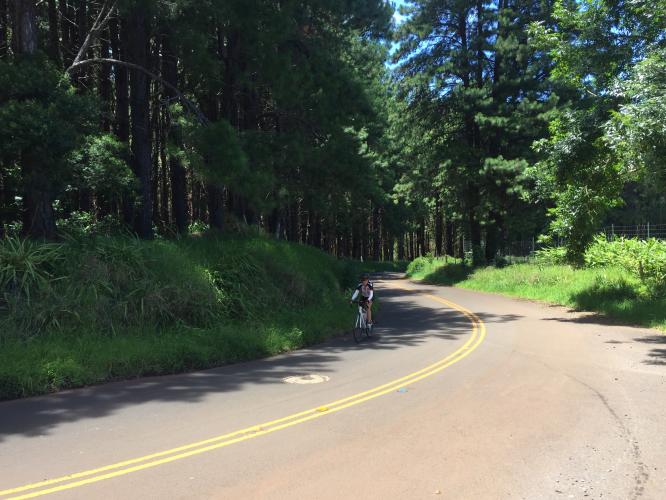
The first 8 miles of this climb are mild and scenic - 4.4% average grade (1,888' gained, 3' descended).  

The last 4.4 miles of the climb are where the challenge begins and why this climb qualifies for the Top 100 - 4.4 miles, 9.1% average grade, 2,123'' ascent and 0' descended (you can see the dramatic change in the VeloViewer at the bottom of this page).

Along Olinda Road during last 4.4 miles at 9.1%

You’ll know when you are at the end.

Steepest ¼ mile begins at mile 9.6 (11.7%) and mile begins at 9.2 (10.5%)

Provisions along the way:  Makawao (6 miles from start - market and bakery).  The Roadway surface is good the entire route, but traffic is fairly heavy for the first 7 miles although very mild thereafter.