23.5
PDI
6.4 mi
DISTANCE
3,067 ft
GAINED
9.1 %
AVG. GRADE
FULL CLIMB STATS
Page Contributor(s): Helmuth Dekkers, Netherlands.
INTRO
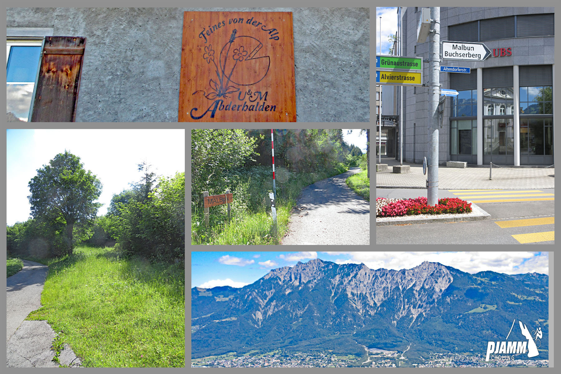
Buchs Malbun climbs 10.3 km (6.4 mi) from the town of Buchs, in the canton of St. Gallen's Rhine Valley, to the Buchserberg and Berghaus Malbun, gaining 935 m (3,067 ft) at a 9.1% average and topping out at about 1399 m (4,591 ft). Despite the name, this is not the road to Liechtenstein's Malbun ski resort - that one starts in Vaduz, directly across the Rhine, and has its own pages (Malbun and Malbun - Old Tunnel Route). This Malbun is a mountain inn and alp high on the Swiss side of the valley, on the eastern flank of the Margelchopf.
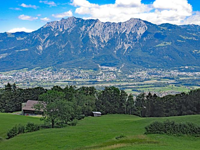
The character of the climb is simple and relentless. After an easy first kilometer out of town, the Buchserbergstrasse settles into 9-11% and barely lets up, climbing mostly through the Buchser Hochwald forest with openings that look down over the Rhine Valley and across to Liechtenstein and the Vorarlberg mountains. The road is narrow, smoothly paved and very quiet - a real contrast to the wide main road up to Liechtenstein's Malbun, and noticeably steeper, too.
Our friend and contributor Helmuth Dekkers first documented this climb for us, and his verdict still holds: a small, quiet road that makes you work hard for its modest length. One thing has changed for the better since then - Berghaus Malbun near the top runs a full restaurant and hotel again, with a terrace that looks out over the whole Rhine Valley toward Lake Constance.
PLAN YOUR ROUTE
 We've partnered with Sherpa-Map.com to bring you the best route planning tool. With a PRO Membership you can use this climb as a reference when creating your route.
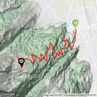
 Buchs Malbun climbs 10.3 km (6.4 mi) at a 9.1% average, gaining 935 m (3,067 ft) from about 465 m (1,524 ft) in Buchs to about 1399 m (4,591 ft) on the Buchserberg.
The first kilometer, along the edge of town, is the only easy one at under 3%. From there the grade locks in: every kilometer from the 2nd through the 7th averages between 9% and 10%. Rather than easing near the top, the climb gets harder - kilometers 8, 9 and 10 average 10.6%, 11.0% and 10.0% - before it finally relents slightly over the last few hundred meters.
The steepest half kilometer averages 12.2%, the steepest kilometer 11.6%, the steepest mile 11.4%, the steepest 2 km 11.4%, and the steepest 5 km 10.2%.
Roadway: The Buchserbergstrasse is paved the entire way and is narrow but in very good condition - riders consistently describe smooth asphalt with hardly a pothole. Above roughly 1260 m the road splits into several branches; follow the signs for Berghaus Malbun, and note that some of the older alp roads beyond are gated or closed to motor vehicles. The upper road holds snow in winter, when the Buchserberg runs a small family ski lift.
Traffic: Very light. The road serves a scattering of farms and houses plus Berghaus Malbun, so expect the occasional local car, the Buchserberg bus that runs from Buchs on Saturdays and Sundays year-round, and a few more cars on fine weekends when hikers head up.
Parking: Buchs is a regional town with public parking in the center and around the railway station, less than 1 km from the start. Buchs SG station is served by both Swiss and Austrian trains, which makes this one of the easier climbs in the region to reach without a car. At the top, Berghaus Malbun has parking directly in front of the house.
Gear: A compact crankset with a 32- or 34-tooth low cog is a sensible choice. The average is 9.1%, but there's no real recovery after the first kilometer, and the three hardest kilometers come at the very end, when your legs are already cooked.
Provisions: Stock up in Buchs - there's nothing along the road itself. Berghaus Malbun at the top runs a restaurant with a hot kitchen into the evening and is open daily, though it adjusts its hours in bad weather, so check ahead if the forecast is poor. Pack a layer for the descent; the top sits nearly 1000 m above the valley floor.
Before heading out on any cycling adventure check out our Things to Bring on a Cycling Trip and use our interactive check list to ensure you don't forget anything.
Buchs sits right on the Liechtenstein border, and Vaduz is just across the Rhine bridge, so it's easy to pair this climb with Liechtenstein's own Malbun climbs on the same day - the two Malbuns face each other across the valley. Just northwest of the start, the tiny medieval Städtli Werdenberg, with its castle rising above a small lake, is one of Switzerland's smallest historic towns and an easy post-ride detour on flat roads.
Berghaus Malbun is a base for hikes as well as a lunch stop: marked trails lead up toward the Margelchopf (2163 m) and the Alvier group above, and in winter the same slopes are a starting point for ski and snowshoe tours. If you'd like to stay up top, the Berghaus has panoramic rooms, and the weekend bus back to Buchs is an option for non-riding companions.
The Rhine Valley between Buchs and Sargans is dense with steep climbs - see other climbs nearby, or build a custom route from here, with our Routes in the Area tool.
ROUTE MAP
MEMBER RATING
CURRENT WEATHER
PJAMM TRIPS ADVENTURE STARTER BUNDLES
Check out PJAMM Adventure's prepackaged (self-guided) cycling trips. They will help you plan, document and conquer your next adventure.
NEARBY CLIMBS (0) RADIAL PROXIMITY
FROM No Climbs Found
MEMBER REVIEWS & COMMENTS
Let us know what you thought of this climb. Signup for our FREE membership to write a review or post a comment.
Already have an account?
LOG IN HERE