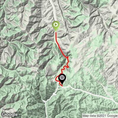
12.7
PDI
8.6 mi
DISTANCE
2,327 ft
GAINED
5.1 %
AVG. GRADE
FULL CLIMB STATS
INTRO
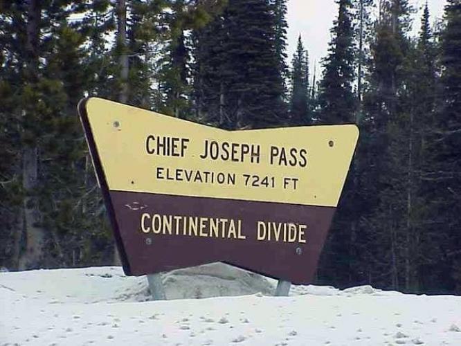
"The climb of Trail Pass North/Chief Joseph Pass West is a steady grade ascent to altitude to the boarder of Idaho in southwestern Montana. There is a bit of traffic on this hill at times but usually not enough to ruin a ride. The road swings through a few curves along the way and with rock walls in places. Trees close in toward the top and at mile 7.2 you reach Trail Pass and the Idaho border. Turn left (east) here on Route 43 to finish. This final section is again steady grade and scenic up to signed Chief Joseph Pass. Trail Pass/Chief Joseph Pass is a pleasant and somewhat fast in places descent as well." (This quote is presented with the approval of John Summerson, from his book, The Complete Guide to Climbing (by Bike), 2nd Edition, pg. 190.)
PLAN YOUR ROUTE
See more details and tools regarding this climb's grade via our interactive Profile Tool.
Information Not Available
If you have any information regarding this climb, we'd like to hear from you. Click the CONTRIBUTE button to share your thoughts with us.
Information Not Available
If you have any information regarding this climb, we'd like to hear from you. Click the CONTRIBUTE button to share your thoughts with us.
Before heading out on any cycling adventure check out our Things to Bring on a Cycling Trip and use our interactive check list to ensure you don't forget anything.
Information Not Available
If you have any information regarding this climb, we'd like to hear from you. Click the CONTRIBUTE button to share your thoughts with us.
ROUTE MAP
MEMBER RATING
CURRENT WEATHER
PJAMM TRIPS ADVENTURE STARTER BUNDLES
Check out PJAMM Adventure's prepackaged (self-guided) cycling trips. They will help you plan, document and conquer your next adventure.
NEARBY CLIMBS (0) RADIAL PROXIMITY
FROM No Climbs Found
MEMBER REVIEWS & COMMENTS
Let us know what you thought of this climb. Signup for our FREE membership to write a review or post a comment.
Already have an account?
LOG IN HERE