![]()
Cycling Pragelpass East
Ride 21.1 kilometers gaining 1,072 meters at 5% average grade.
This is a very scenic ride on a mildly travelled narrow roadway past Lake Klöntalersee to Pragel Pass. Pragel Pass is closed on weekends to motorized vehicles making it an excellent cycling experience. This climb is located in the Glarus Alps, a subrange of the Alps located in central Switzerland.
![]()
Climb summary from PJAMM friend and contributor Helmuth Dekkers (NL).
I took the eastern ascent and hence started from Glarus. The kilometers that take you out of Glarus to Riedern (525m) are easy just 4% on average. From Riedern the actual climbing starts and you can look ahead to an impressive rockface. Just before it the road sweeps to the left to follow this rockface.
From Riedern it is 4km to the Klöntalersee (848m) with an average of 8%. But don't let that average value fool you as there is a 1.5km part in between of just 4% and prior to that and after that stretch it's around 10%!
![]()
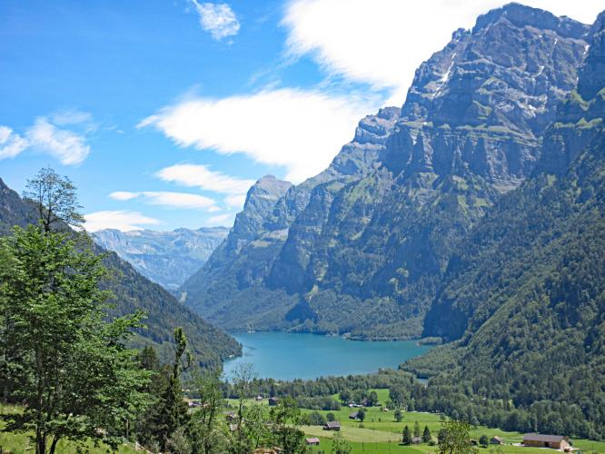
The scenery is beautiful along the climb . . .
. . . well, you are cycling in Switzerland, after all . .
The Klöntalersee is a natural lake and the view on this blue lake with the mountains rising high up around it is very beautiful. Nice reward for the uphill part you just cycled. It's also nice that you cycle for 4.5km on a flat part along the lake though the road is quite narrow at places and there can be quite some traffic as there is a campsite on the western side of the lake.
![]()
From the end of the lake there are still some 10.5km left to the actual pass with an average of 6.6%. But note that there is a flatter piece of ~4% after 3km and the parts before and after are steeper and then there are also some steep ramps in there with a lot higher gradient and so it's not an easy ride to the pass! The increase of the gradient and ramps coincides with where the road turns away from the torrent. The last kilometer the valley opens up and this enhances the view on the surrounding mountains so the view on the summit is really nice.
![]()
Please note it is possible to descend down to Brunnen and then to cycle along the Vierwaldstattersee to Flüelen and then on to Altdorf to cycle up via the Klausenpass to Linthal to get back to Glarus. This is a 127km loop with close to 3,000m difference of level.

 We've partnered with Sherpa-Map.com to bring you the best route planning tool. With a PRO Membership you can use this climb as a reference when creating your route.


