Etzelpass North Bike Climb - PJAMM Cycling

5.3
FIETS
3.1 mi
DISTANCE
1,694 ft
GAINED
10.4 %
AVG. GRADE

FULL CLIMB STATS

Page Contributor(s): Helmuth Dekkers, Netherlands. Ard Oostra, Montreux, Switzerland.

INTRO

This 3.1 mile bike climb is located in Schwyz, Switzerland. The average gradient is 10.4% and there is a total elevation gain of 1,694 ft, finishing at 3,082 ft.

Use the profile tool, route map, and weather forecast to conquer this cycling climb.

See more details and tools regarding this climb's grade via our interactive Profile Tool.
Information Not Available

If you have any information regarding this climb, we'd like to hear from you. Click the CONTRIBUTE button to share your thoughts with us.

Information Not Available

If you have any information regarding this climb, we'd like to hear from you. Click the CONTRIBUTE button to share your thoughts with us.

Before heading out on any cycling adventure check out our Things to Bring on a Cycling Trip and use our interactive check list to ensure you don't forget anything.
Information Not Available

If you have any information regarding this climb, we'd like to hear from you. Click the CONTRIBUTE button to share your thoughts with us.

ROUTE MAP

MEMBER RATING

Not Yet Rated
-
Road
-
Traffic
-
Scenery

CURRENT WEATHER

PJAMM TRIPS ADVENTURE STARTER BUNDLES

Check out PJAMM Adventure's prepackaged (self-guided) cycling trips. They will help you plan, document and conquer your next adventure.
ALL TRIPS
Browse all of our prepackaged trips and find your next adventure!

NEARBY CLIMBS (0) RADIAL PROXIMITY

FROM
No Climbs Found

MEMBER REVIEWS & COMMENTS

Let us know what you thought of this climb. Signup for our FREE membership to write a review or post a comment.
Already have an account?
ROUTE MAP
PROFILE TOOL
Route Data
S.G. (%)
hide
Segment Data
hide

Climb Profile Not Found
CLIMB SUMMARY

Cycling Etzelpass North

Ride 5 kilometers gaining 516 meters at 10.3% average grade.

This is a tough climb with a particularly hard segment that averages 13.6% near the middle of the climb - but, the climb is steep throughout.

Climb summary from PJAMM friend and contributor Helmuth Dekkers.

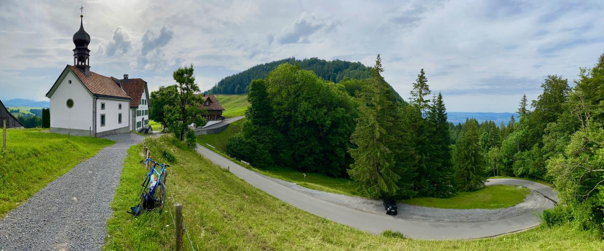
This is not a long ascent from the north from Pfäffikon. Just 5km. But the average gradient is very close to 11%. So not long but still tough. The first 500m from Pfäffikon are to get warm at 5%. Then the gradient ramps up to take you out of town and over the A3 highway. You then get a nice view on the Zurich lake. After 2.5km there is a turn to the left that takes you through the woods and with high gradients, on average close to 13%, to the pass. At the pass there is the Saint Meinrad chappell (Mein rad in German means My bike. This cannot be a coincidence, can it?) which is on the pilgrims route to Santiago de Compostella in Portugal. There is also a Guesthouse at the pass where you can have a drink or something to eat.

The climb begins in Pfaffikon on the southeastern shore of Lake Zurich

We have views of Lake Zurich at the lower part of the climb.

From the pass you have a nice view on the southern slope. That southern side has much less difference of altitude gain 151m vs 535m and though the length is almost equal from Einsiedeln it's only the last kilometer which has a double digit gradient. Hence this side is less interesting I think.

Did we mention that this climb is STEEEEP??