![]()
Cycling Schrina - Hochrugg
Ride 8.8 kilometers gaining 974 meters at 11.2% average grade.
This is a very challenging bike climb in northeastern Switzerland near its border with Liechtenstein. The grade on this climb, particularly through the middle is severe - one kilometer at 14% and two kilometers at 13.8%.
![]()
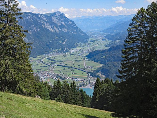
Many views of the Walensee (Lake Walenstadt) as we climb.
Climb summary by PJAMM friend and contributor Helmuth Dekkers (NL).
Walenstadt (2018 population 5,679) is the start town of a little known but tough ascent up to Schrina-Hochrugg. The Hochrugg lies at the foot of the Hinterrugg which is the highest peak (2,306m) of the Churfirsten mountain range. From Walenstadt you can already see a large building higher up the Churfirsten mountains. This is a so-called Rehab Center and you will pass it on your way up to Schrina-Hochrugg. This is not a rehabilitation clinic for alcohol or drug addiction but for people with mental/physical problems.
![]()
Anyway, to get there you already have quite a hurdle to overcome. The 1st 400m out of Walenstadt are not too bad. But then the climb goes into double figure gradients and hardly goes below that anymore. Only around 3km of cycling near to Restaurant Stauffacher there it let's go briefly to 6% and then continues at 13% for the next 2km to the Rehab Center. And after that it does NOT get better. It continues in the same fashion with ~13.5% for another 2.5km to Rug-Beizli a small restaurant where you can have a drink if you are cycling this ascent on the weekend. The top of the BIG 556 is located some 200m further where there is a building and a cattle grid. From there can continue TO Rug-Beizli by the way for another 1.3km at 9.5% if you like until the tarmac turns into gravel.
![]()
Well, after I have gone on and on about the bad news, i.e. the high gradients, there is also good news. There is hardly any traffic on the road and the surface is good. And the ascent offers very nice views to the Churfirsten mountains rising up high to the left of you and on the Walensee occasionally to the right of you. You can also most likely enjoy the colorful paragliders who soar down from Schrina-Hochrugg back to Walenstadt. I recommend that on the way down you cycle up to the parking place of the Rehab center as it offers a beautiful panoramic view on the blue Walensee some 500m below you. A nice reward of the hard work you had to put into the ascent.
![]()
Thank you Helmuth!!

 We've partnered with Sherpa-Map.com to bring you the best route planning tool. With a PRO Membership you can use this climb as a reference when creating your route.

