![]()
Cycling Vorder Höhi
Ride 11.2 kilometers gaining 1,084 meters at 9.7% average grade.
This climb begins in the village of Weesen (218 population 1,723).
![]()
Climb summary from PJAMM’s friend and contributor Helmuth Dekkers (NL).
The Walensee lake in Switzerland is beautiful. On the north side the Churfirsten mountain range rises almost vertically for 2,000m up from the lakeside. And you can clearly see the 7 peaks that form the serrated ridge. Beautiful! There is a nice campsite on the eastern shore of the lake that offers a fantastic view on the lake and the Churfirsten next to it.
From Walenstadt one can cycle along a cycling track to Weesen (422m) or one cycles via the N3 and the Kerenzerbergpass (743m) and Mollis to Weesen. The latter is a nice detour that adds 10km of cycling with 350m of climbing but it does offer nice views on the lake and on the Vorder Höhi pass on the north-west side of the lake.
The actual climb starts in Weesen and after 1km with 6.5% there are 4km to Amden with an average gradient of 11%! The nice views on the lake help to distract the mind a bit from the hard work. In Amden the gradient goes down to a welcome 8%. And after Amden there is the turnoff. A very narrow road, which is closed to motorized traffic a little further, which leads to the Vorde Höhi mountain pass (1553m). This is again hard labor as the next 2 km are 12.5% on average. I read the names of the segments on Strava and it said:
1) No walking allowed! for a 100m stretch of 18.5%
2) Tough shit zu de Vorderi Höhi.
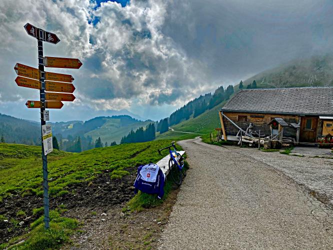
And it is indeed a tough part but very rewarding as this part is so quiet and very scenic. I did see someone step down on that 100m part and I myself had to lean forward to keep my wheel on the road there but I made it without stepping down. The last part to the pass is a straight line and hence feels quite hard too. When I arrived at the pass there where some cyclists on MTB who were surprised I was there on my road bike. Well, it's a stiff climb but the surface is good so a road bike is OK for this climb.
I descended on the other side to Starkenbach (893m) via a 6.9km, narrow, steep concrete road with quite rough surface. The average gradient is 9.3% but it looked and felt much steeper. My disc brakes started to scream as I really had to slow down hard for the hairpin turns, it's that steep. From Starkenbach one can continue to Wildhaus (1090m so just a mild ascent) and descent further down to Buchs (474m).
In Buchs you can test your legs again with the tough Buchs-Malbun climb (1357m difference of level. 9.6km long and 9.4% on average) or cycle back to Walenstadt via a flat road.
The complete trip is 110km long, if you cycle along the lake, with ~2,500m difference of level when you include Buchs-Malbun. I can't imagine a better way of spending the day :-)

 We've partnered with Sherpa-Map.com to bring you the best route planning tool. With a PRO Membership you can use this climb as a reference when creating your route.

