19.8
PDI
12.7 mi
DISTANCE
3,651 ft
GAINED
5.4 %
AVG. GRADE
FULL CLIMB STATS
Page Contributor(s): Helmuth Dekkers
INTRO
Fafleralp is a long, steady climb of 20.4 km (12.7 mi) from Steg-Hohtenn in the Rhône valley up the Lötschental, in a little-used corner of eastern Valais. It gains 1,112.8 m (3,651 ft), from 643.7 m (2,112 ft) to 1,752.9 m (5,751 ft), at a 5.4% average, with the steepest kilometer at 10.0%. It ranks #1,020 on our list of the world's hardest climbs.
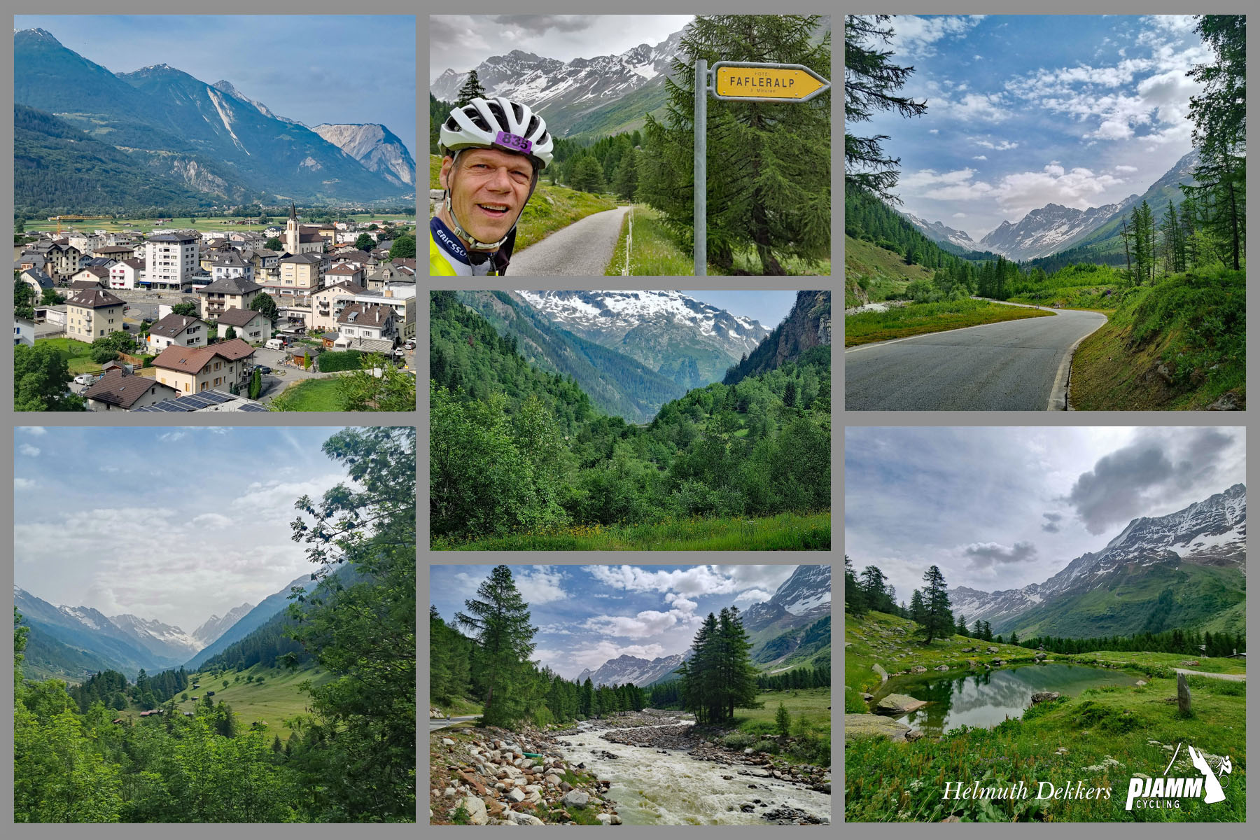
Our ambassador Helmuth Dekkers rode it and describes the first 4.3 km (2.7 mi) as the enjoyable part, with hairpin bends and valley views, up to the new Mittal tunnel. The tunnel is 2.6 km (1.6 mi) long. He found it manageable but no fun and recommends avoiding busy holiday periods. There is no way around it because the bridge on the old route is closed, and he recommends riding with at least one rear light, even though the tunnel is lit. After the tunnel, traffic is lighter and the scenery is very nice.
Road status matters here. The 28 May 2025 glacier collapse buried much of Blatten, and the cantonal road from Blatten to Fafleralp reopened on 26 June 2026 on a new, monitored alignment below the Oigschtchummun glacier. At the reopening, cyclists and pedestrians remained barred from the affected section, and motor access is restricted, with a reserved shuttle from Lauchernalp to Fafleralp from 27 June to 1 November 2026. Check with Lötschental Tourism or the Valais mobility office before planning to ride above Wiler.
PLAN YOUR ROUTE
 We've partnered with Sherpa-Map.com to bring you the best route planning tool. With a PRO Membership you can use this climb as a reference when creating your route.
Fafleralp averages 5.4% over 20.4 km (12.7 mi), gaining 1,112.8 m (3,651 ft) from 643.7 m (2,112 ft) in Steg-Hohtenn to 1,752.9 m (5,751 ft).
The steepest 0.5 km (0.3 mi) averages 10.7%, the steepest kilometer 10.0%, the steepest 2 km (1.2 mi) 9.1% and the steepest 5 km (3.1 mi) 8.5%, while the steepest 10 km (6.2 mi) average 7.1%. Riders find the hairpins above the Rhône valley the hardest stretch, and the road through the Lötschental is gentler, with a few shorter steep sections. The last kilometer to Fafleralp is steep, near 10%.
Roadway: The road is paved throughout. The lower section climbs in hairpins to the 2.6 km (1.6 mi) Mittal tunnel, which is lit and has no bypass because the bridge on the old route is closed. Above Goppenstein the road runs up the Lötschental through Ferden, Kippel and Wiler to Blatten. Since 26 June 2026 the cantonal road beyond Blatten to Fafleralp has been open with restrictions: motor vehicles must keep a minimum of 30 km/h and may not stop on the affected section, which passes beneath the monitored Oigschtchummun glacier. Cyclists and pedestrians remain barred from that section.
Traffic: Traffic can be heavy in the tunnel at busy holiday times, and cars arrive in bunches from the Lötschberg car shuttle at Goppenstein. The upper valley road is narrow and watch for the PostBus. After the tunnel, traffic is lighter.
Parking: The Lötschberg railway has stations at Hohtenn and Gampel-Steg, and the PostAuto serves the valley from Gampel-Steg and Goppenstein. At present cars cannot drive directly to Fafleralp: park in Wiler, take the gondola to Lauchernalp, then the reserved minibus to Fafleralp (daily from 27 June to 1 November 2026).
Provisions: Hotel Fafleralp, at almost 1,800 m (5,906 ft), reopened to overnight guests on 4 July 2026 and to day guests on 20 July 2026, with a restaurant. Stock up in the valley villages before you begin.
Gear: Ride with a rear light and a front light for the 2.6 km (1.6 mi) Mittal tunnel. Pack a jacket: the Lötschental is a high glacial valley and cooler than the Rhône valley below.
Before heading out on any cycling adventure check out our Things to Bring on a Cycling Trip and use our interactive check list to ensure you don't forget anything.
The Lötschental is known for its isolation and for the Tschäggättä, the shaggy, carved-mask figures of its carnival. The Lötschentaler Museum in Kippel holds more than 350 masks, the oldest dating from 1790 to 1810, and the carnival itself runs in February before Ash Wednesday, with a Thursday night run from Blatten to Ferden. In Kühmatt, above Blatten, the Baroque chapel Mariä Heimsuchung is a pilgrimage site, and the whole upper valley lies within the UNESCO Jungfrau-Aletsch World Natural Heritage area.
Blatten was largely buried by the 2025 glacier collapse, and the canton and municipality have set a goal of rebuilding the village by 2029. The Wiler-Lauchernalp cable car is seasonal and runs into early November, and Hotel Fafleralp, which also owns the Langgletscherhaus, is the destination at the top. Our Chandolin and Moosalp pages cover climbs in other Valais valleys, and you can see other climbs nearby, or build a custom route from here, with our Routes in the Area tool.
ROUTE MAP

MEMBER RATING
CURRENT WEATHER
PJAMM TRIPS ADVENTURE STARTER BUNDLES
Check out PJAMM Adventure's prepackaged (self-guided) cycling trips. They will help you plan, document and conquer your next adventure.
NEARBY CLIMBS (0) RADIAL PROXIMITY
FROM No Climbs Found
MEMBER REVIEWS & COMMENTS
Let us know what you thought of this climb. Signup for our FREE membership to write a review or post a comment.
Already have an account?
LOG IN HERE