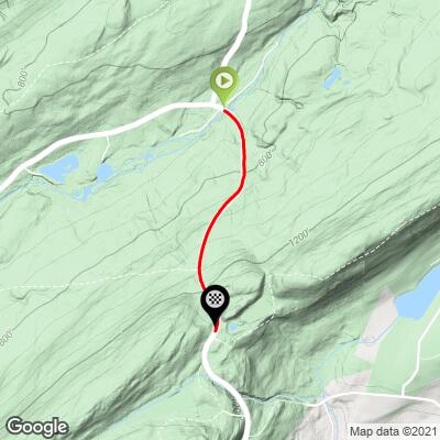
Millbrook Road  Bike Climb - PJAMM Cycling

2.2
FIETS
1 mi
DISTANCE
613 ft
GAINED
11.6 %
AVG. GRADE

FULL CLIMB STATS

Page Contributor(s): Dan Razum, San Jose, CA; Patrick Merrill, South Bound Brook, NJ

INTRO

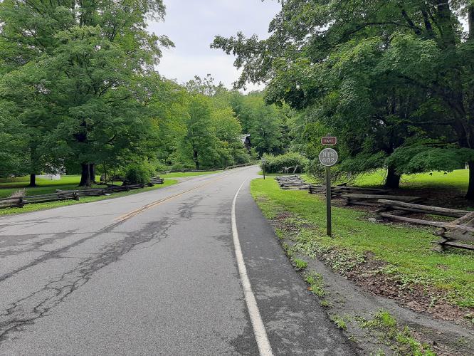
This is the second steepest mile in New Jersey at 11.6%. 

See more details and tools regarding this climb's grade via our interactive Profile Tool.
Information Not Available

If you have any information regarding this climb, we'd like to hear from you. Click the CONTRIBUTE button to share your thoughts with us.

Information Not Available

If you have any information regarding this climb, we'd like to hear from you. Click the CONTRIBUTE button to share your thoughts with us.

Before heading out on any cycling adventure check out our Things to Bring on a Cycling Trip and use our interactive check list to ensure you don't forget anything.
Information Not Available

If you have any information regarding this climb, we'd like to hear from you. Click the CONTRIBUTE button to share your thoughts with us.

ROUTE MAP

MEMBER RATING

Not Yet Rated
-
Road
-
Traffic
-
Scenery

CURRENT WEATHER

PJAMM TRIPS ADVENTURE STARTER BUNDLES

Check out PJAMM Adventure's prepackaged (self-guided) cycling trips. They will help you plan, document and conquer your next adventure.
ALL TRIPS
Browse all of our prepackaged trips and find your next adventure!

NEARBY CLIMBS (0) RADIAL PROXIMITY

FROM
No Climbs Found

MEMBER REVIEWS & COMMENTS

Let us know what you thought of this climb. Signup for our FREE membership to write a review or post a comment.
Already have an account?
ROUTE MAP
PROFILE TOOL
Route Data
S.G. (%)
hide
Segment Data
hide

Climb Profile Not Found
CLIMB SUMMARY

Cycling Millbrook-Flatbrook Roads

Ride 1 mile gaining 613’ at 11.6% average grade.

Climb summary by PJAMM ambassador Dan Razum.

The climb starts at the Millbrook Village Historic Site, where there is a small parking area. We cross Van Campens Brook and the road tilts upwards at double digits right from the start. The climb isn't too long but it is steep the whole way through.

It starts out nice and shady, with trees overhanging the road but as we progress the trees get further from the road and we are more exposed to the sun.  The pavement is in decent condition and there is a small shoulder in places. But there isn't much traffic and, since we are in the Delaware Water Gap recreational area, what traffic we did encounter was slow and courteous.  

Partway up there is a cut in the trees for power lines.  This provides a small view, which is the only scenic view along the climb. Other than this, the view is pretty much always the same: a steep road stretching out in front with no end in sight!  

There is just enough curvature so that we can't see the top until we are almost there.  The top is unmarked but obvious and the Appalachian Trail  crosses the road at the top.