6.4
PDI
5.5 mi
DISTANCE
1,364 ft
GAINED
4.7 %
AVG. GRADE
FULL CLIMB STATS
INTRO
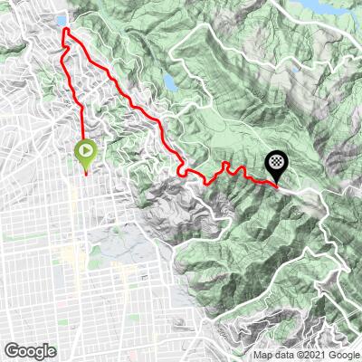
This 5.5 mile bike climb is located in CA, USA. The average gradient is 4.7% and there is a total elevation gain of 1,364 ft, finishing at 1,656 ft.
Use the profile tool, route map, and weather forecast to conquer this cycling climb.
Use the profile tool, route map, and weather forecast to conquer this cycling climb.
PLAN YOUR ROUTE
See more details and tools regarding this climb's grade via our interactive Profile Tool.
Information Not Available
If you have any information regarding this climb, we'd like to hear from you. Click the CONTRIBUTE button to share your thoughts with us.
Information Not Available
If you have any information regarding this climb, we'd like to hear from you. Click the CONTRIBUTE button to share your thoughts with us.
Before heading out on any cycling adventure check out our Things to Bring on a Cycling Trip and use our interactive check list to ensure you don't forget anything.
Information Not Available
If you have any information regarding this climb, we'd like to hear from you. Click the CONTRIBUTE button to share your thoughts with us.
ROUTE MAP
MEMBER RATING
CURRENT WEATHER
PJAMM TRIPS ADVENTURE STARTER BUNDLES
Check out PJAMM Adventure's prepackaged (self-guided) cycling trips. They will help you plan, document and conquer your next adventure.
NEARBY CLIMBS (0) RADIAL PROXIMITY
FROM No Climbs Found
MEMBER REVIEWS & COMMENTS
Let us know what you thought of this climb. Signup for our FREE membership to write a review or post a comment.
Already have an account?
LOG IN HERE
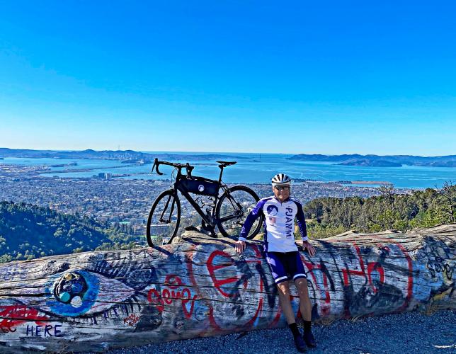
geraldbiz
Beautiful climb out of Berkeley, CA. Starts out on small, Berkeley-style roads with a fair amount of traffic, but eventually goes up higher into the mountain areas at Grizzly Peak. The road condition is excellent, and while there can be a fair amount of traffic on some days, most days are pretty sparse. If you're feeling strong, try heading to Seaview Trail at the top of Grizzly Peak, which has a final 1 km kicker of around 14%, with even more stunning views of the reservoir, Orinda, and Mt. Diablo. Stunning sunsets.