Lac Tanay Bike Climb - PJAMM Cycling

26.2
PDI
6.8 mi
DISTANCE
3,340 ft
GAINED
9.4 %
AVG. GRADE

FULL CLIMB STATS

Page Contributor(s): Ard Oostra, Montreux, Switzerland

INTRO

This 6.8 mile bike climb is located in Valais, Switzerland. The average gradient is 9.4% and there is a total elevation gain of 3,340 ft, finishing at 4,623 ft.

Use the profile tool, route map, and weather forecast to conquer this cycling climb.

See more details and tools regarding this climb's grade via our interactive Profile Tool.
Information Not Available

If you have any information regarding this climb, we'd like to hear from you. Click the CONTRIBUTE button to share your thoughts with us.

Information Not Available

If you have any information regarding this climb, we'd like to hear from you. Click the CONTRIBUTE button to share your thoughts with us.

Before heading out on any cycling adventure check out our Things to Bring on a Cycling Trip and use our interactive check list to ensure you don't forget anything.
Information Not Available

If you have any information regarding this climb, we'd like to hear from you. Click the CONTRIBUTE button to share your thoughts with us.

ROUTE MAP

MEMBER RATING

Not Yet Rated
-
Road
-
Traffic
-
Scenery

CURRENT WEATHER

PJAMM TRIPS ADVENTURE STARTER BUNDLES

Check out PJAMM Adventure's prepackaged (self-guided) cycling trips. They will help you plan, document and conquer your next adventure.
ALL TRIPS
Browse all of our prepackaged trips and find your next adventure!

NEARBY CLIMBS (0) RADIAL PROXIMITY

FROM
No Climbs Found

MEMBER REVIEWS & COMMENTS

Let us know what you thought of this climb. Signup for our FREE membership to write a review or post a comment.
Already have an account?
ROUTE MAP
PROFILE TOOL
Route Data
S.G. (%)
hide
Segment Data
hide
CLIMB SUMMARY

Cycling Lac Tanay

Ride 11 kilometers gaining 1,027 meters at 9.5% average grade.

This is another of the many Swiss Rhone Valley bike climbs in the greatest climbing area in the world.

Climb begins in Vouvry (2018 population 4,198)

Views back to as we begin our climb looking back to Vouvry and the Valley of the Rhone.

Parking lot at kilometer.

From Vouvry we ride up towards Le Grammont, a foreboding mountain in the Chabias Alps subrange of the Alps. Grammont at 2172m is our ultimate destination, but we will have to hike to get there.  We pass through the village of Miex about half way between Vouvry and the parking lot.

The paved road ends at the parking lot at kilometer 9.

The paved road to the parking lot is 9 kilometers at an average grade of 7.8%.  The remaining 2 kilometers is on gravel at an extraordinary 17% average grade.  This section is barely manageable on a road bike.  While it is possible to accomplish this portion of the climb on road bike (with at least 28mm tires), a gravel or mountain bike is recommended.

The biking portion of this route ends at Col de Tanay just below Lac de Tanay.

There are hotels and restaurants at Lac de Tanay.  From here, we hike 5.3 kilometers and 707 meters to the top of Le Grammont.

Now THAT’S steeeeeepppppp!!!!

About 4 kilometers between Lac de Tanay and Grammont peak are manageable on mountain bike.

The last 1.1 kilometers must be hiked and cannot be ridden by any type of bicycle.

Le Grammont is sometimes referred to as Col des Crosses.

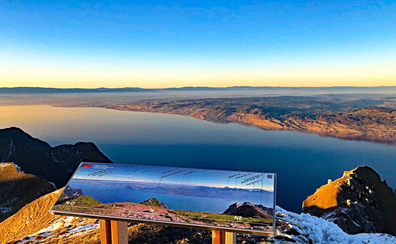
There are no better views of Lake Geneva than from the top of Le Grammont.

Le Grammont during the summer.

Thank you Ard Oostra, Montreux, Switzerland.