10.5
PDI
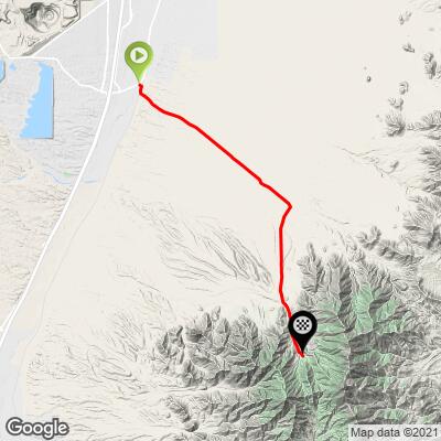
13.3 mi
DISTANCE
2,499 ft
GAINED
3.5 %
AVG. GRADE
FULL CLIMB STATS
Page Contributor(s): Bo Jensen, Syracuse, NY, USA; Louis Roth, Pacifica, CA, USA
INTRO
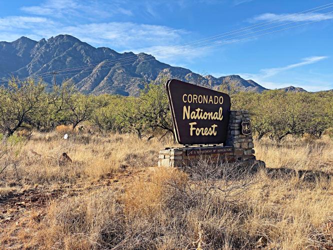
This 13.3 mile bike climb is located in AZ, USA. The average gradient is 3.5% and there is a total elevation gain of 2,499 ft, finishing at 5,341 ft.
Use the profile tool, route map, and weather forecast to conquer this cycling climb.
Use the profile tool, route map, and weather forecast to conquer this cycling climb.
PLAN YOUR ROUTE
See more details and tools regarding this climb's grade via our interactive Profile Tool.
Parking:
Off the side of the road near the start of the climb, or at the amphitheater parking lot at the top of the climb
Information Not Available
If you have any information regarding this climb, we'd like to hear from you. Click the CONTRIBUTE button to share your thoughts with us.
Before heading out on any cycling adventure check out our Things to Bring on a Cycling Trip and use our interactive check list to ensure you don't forget anything.
If you're in Tucson, don't miss out on the world-class Mexican food. Some of our favorites include:
Charro Steak & Del Rey; Los Tacos Apson; El Charro Cafe (the first Mexican restaurant established in the United States!)
Local Brews (☕️+🍻): Presta Coffee Roasters; Tombstone Brewing Co. (about an hours drive southwest between Tucson and Mt. Graham)
ROUTE MAP
MEMBER RATING
CURRENT WEATHER
PJAMM TRIPS ADVENTURE STARTER BUNDLES
Check out PJAMM Adventure's prepackaged (self-guided) cycling trips. They will help you plan, document and conquer your next adventure.
NEARBY CLIMBS (0) RADIAL PROXIMITY
FROM No Climbs Found
MEMBER REVIEWS & COMMENTS
Let us know what you thought of this climb. Signup for our FREE membership to write a review or post a comment.
Already have an account?
LOG IN HERE
whitworks
this ride is for you:
1. if you're a fan of long sun-blasted straightaways with tar strips every ten yards and 3% grade
2. if you like riding your swift in reality instead of virtual reality
I recommend parking at the lot where they used to process fees and then just ride the top few miles, using it as a warmup for mt. hopkins down the road
house shaped like a bird house near the top is cool
howletttom1


I stayed at Jeremiah Inn (520.784.1729) - ask for Beth! It's a cyclist's oasis, and I highly recommend it. It's just 200 yards from the Mt. Lemmon start, but unfortunately, it was snowed over on my visit. So, I drove a short 50 minutes to Madera Canyon. My ride started at the La Posada Community Services parking lot (780 S Park Centre Ave, Green Valley, AZ 85614). I stopped by the office for permission, and there's a restroom available there as well. The climb up Madera is a steady 2% grade until mile 10, then it kicks up a bit, but it's still manageable. The last mile is tough, but doable! The road surface on the climb is smooth; you won't notice the expansion cracks every 15-20 feet. They're a little more noticeable on the descent, though. I used 52/36 11/30 gear setup witch was fine but I couldn’t spin the last 1/4 mile. That was more of grind. The ride itself is peaceful, with not much to see until the last few miles. There are restrooms at the top, a camping area, and Madera Kubo