21.3
PDI
15.9 mi
DISTANCE
4,094 ft
GAINED
4.7 %
AVG. GRADE
FULL CLIMB STATS
INTRO
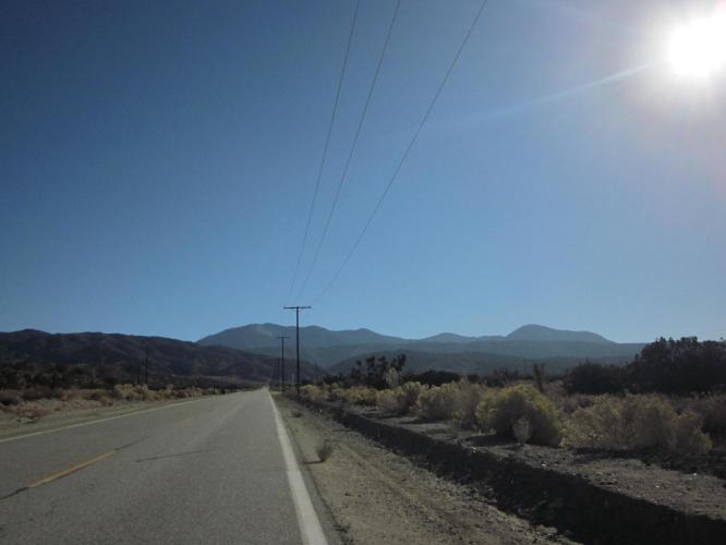
The first three miles of this climb are at 4.3% average grade and we are surrounded by Joshua Trees as we climb toward the mountains. At mile three, the scenery changes as we begin to enter a canyon-like setting and the road ramps up a bit to an average of 6.2% for the next three miles to the left turn from Vista Largo Road onto N4/Big Pines Highway.
"This climb starts out shallow and gradually gets steeper as it heads into a drainage. At the stop sign (mile 6.1) turn left toward Wrightwood. At the intersection with Route 2 (Angeles Crest Highway) at mil 12.7 turn left and immediately take another left up to Table Mountain picnic area. This 1.2 mile finishing stretch is steeper than the previous section..." (This quote is presented with the approval of John Summerson from The Complete Guide to Climbing (by Bike) in California, pg. 203.)
PLAN YOUR ROUTE
See more details and tools regarding this climb's grade via our interactive Profile Tool.
Information Not Available
If you have any information regarding this climb, we'd like to hear from you. Click the CONTRIBUTE button to share your thoughts with us.
Information Not Available
If you have any information regarding this climb, we'd like to hear from you. Click the CONTRIBUTE button to share your thoughts with us.
Before heading out on any cycling adventure check out our Things to Bring on a Cycling Trip and use our interactive check list to ensure you don't forget anything.
Information Not Available
If you have any information regarding this climb, we'd like to hear from you. Click the CONTRIBUTE button to share your thoughts with us.
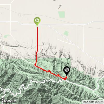
ROUTE MAP
MEMBER RATING
CURRENT WEATHER
PJAMM TRIPS ADVENTURE STARTER BUNDLES
Check out PJAMM Adventure's prepackaged (self-guided) cycling trips. They will help you plan, document and conquer your next adventure.
NEARBY CLIMBS (0) RADIAL PROXIMITY
FROM No Climbs Found
MEMBER REVIEWS & COMMENTS
Let us know what you thought of this climb. Signup for our FREE membership to write a review or post a comment.
Already have an account?
LOG IN HERE