Balch Park Road Bike Climb - PJAMM Cycling

24.5
PDI
18 mi
DISTANCE
4,823 ft
GAINED
4.8 %
AVG. GRADE

FULL CLIMB STATS

INTRO

"The climb up Balch Park is a long and isolate ascent from dry hill country up to giant Sequoias. It is over moderate grade and a narrow road for most of its length. From climb start you begin over a two lane road and a shallow grade which gradually increases. At mile 4.3 the road suddenly narrows to a wide single lane with increased tree cover which remains with you for the majority of the remainder of the hill. There are several switchbacks on this section along with excellent views. Just beyond 12 miles in the grade reduces. Soon a few houses appear in an isolated and dark setting. From here the grade is mostly shallow as you twist along the flanks of the Sierra Nevada..." (This quote is presented with the approval of John Summerson, from his book, The Complete Guide to Climbing (by Bike) in California, pg. 160.)

PLAN YOUR ROUTE

We've partnered with Sherpa-Map.com to bring you the best route planning tool. With a PRO Membership you can use this climb as a reference when creating your route.

See more details and tools regarding this climb's grade via our interactive Profile Tool.
Information Not Available

If you have any information regarding this climb, we'd like to hear from you. Click the CONTRIBUTE button to share your thoughts with us.

Information Not Available

If you have any information regarding this climb, we'd like to hear from you. Click the CONTRIBUTE button to share your thoughts with us.

Before heading out on any cycling adventure check out our Things to Bring on a Cycling Trip and use our interactive check list to ensure you don't forget anything.
Information Not Available

If you have any information regarding this climb, we'd like to hear from you. Click the CONTRIBUTE button to share your thoughts with us.

ROUTE MAP

MEMBER RATING

Not Yet Rated
-
Road
-
Traffic
-
Scenery

CURRENT WEATHER

PJAMM TRIPS ADVENTURE STARTER BUNDLES

Check out PJAMM Adventure's prepackaged (self-guided) cycling trips. They will help you plan, document and conquer your next adventure.
ALL TRIPS
Browse all of our prepackaged trips and find your next adventure!
Sequoia and Kings Canyon
United States (CA)
15 ROUTES
11 POIs
ROUTE STATS (TOTAL)
281
mi
DISTANCE
77,122
ft
ELEV. GAIN

NEARBY CLIMBS (0) RADIAL PROXIMITY

FROM
No Climbs Found

MEMBER REVIEWS & COMMENTS

Let us know what you thought of this climb. Signup for our FREE membership to write a review or post a comment.
Already have an account?
ROUTE MAP
PROFILE TOOL
Route Data
S.G. (%)
hide
Segment Data
hide
CLIMB SUMMARY

CLIMB SUMMARY

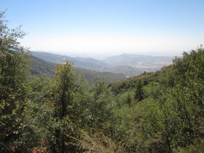
Balch Park Road is a loop that includes Bear Creek Road.  Two other Top 100 climbs are within 8 miles of the start of Balch Park Road (#21 Bear Creek Road [2.8 miles] and #40 Hwy 190 [7.5 miles]).  As with Bear Creek Road, Balch Park enters the Sequoia National Forest in the first quarter of the climb (at mile ~5.7).    At 4.9% average grade, this is a fairly  tame climb and does not present the extremely steep climbing segments that Bear Creek Road just over the hill does. The first half of the climb is 5.6% average grade and the  second about 4.2%.  The Balch Park area has many recreational activities and camping to tack onto the climb trip if desired. The first 9 miles of the climb take us through  generally unattractive scrub brush, but with some dynamic views of granite mountain faces between miles 4-8.  We begin to enjoy the true Sequoia National Forest around  miles 9-10 and the scenery gets more and more dramatic as we ascend.

IMG_1237.JPG     IMG_2178.JPG

Inauspicious start but spectacular finish!


Traffic and Roadway report:  The roadway surface, other than the first few miles, is very poor,  rutted, pot-holed and with plenty of loose gravel that makes for a rough and bumpy  descent.  There is a bit more trailer traffic on this side of the mountain than the Bear Creek side, but this is still light and the motorists we encountered were always respectful  and often offered an encouraging shouts and waves.

IMG_2201.JPG

Climb #8 of our 4-day Southwestern Sierra climb trip.


Steepest ½ mile starts at mile 4.3 (8.6%)