20.5
PDI
8.7 mi
DISTANCE
3,164 ft
GAINED
6.9 %
AVG. GRADE
FULL CLIMB STATS
INTRO
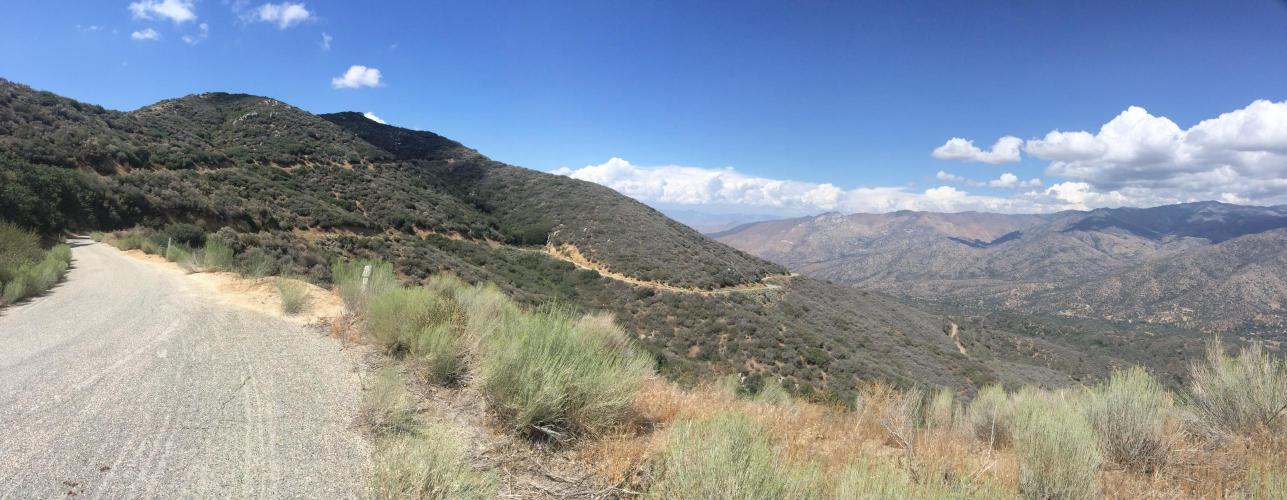
"The east side of Breckinridge Road near Bakersfield, CA is an amazing climb that seems made more for bikes than motorized vehicles. Beginning in the scrub sage, it is along a wide one lane road and ends among the tall pines on top. Along the way you must negotiate steep ramps and tight turns although the road carries little traffic. There is a cattle guard at climb start (and two more along the way) and the grade is stout immediately. It soon eases a bit and is variable for the entire route as you encounter multiple double digit grade ramps...Close to the very top there is one more steep ramp and then the grade eases and soon goes flat as you enter thick trees to complete the climb..." (This quote is presented with the approval of John Summerson, from his book, The Complete Guide to Climbing (by Bike) in California, pg. 168.)
PLAN YOUR ROUTE
See more details and tools regarding this climb's grade via our interactive Profile Tool.
Information Not Available
If you have any information regarding this climb, we'd like to hear from you. Click the CONTRIBUTE button to share your thoughts with us.
Information Not Available
If you have any information regarding this climb, we'd like to hear from you. Click the CONTRIBUTE button to share your thoughts with us.
Before heading out on any cycling adventure check out our Things to Bring on a Cycling Trip and use our interactive check list to ensure you don't forget anything.
Information Not Available
If you have any information regarding this climb, we'd like to hear from you. Click the CONTRIBUTE button to share your thoughts with us.
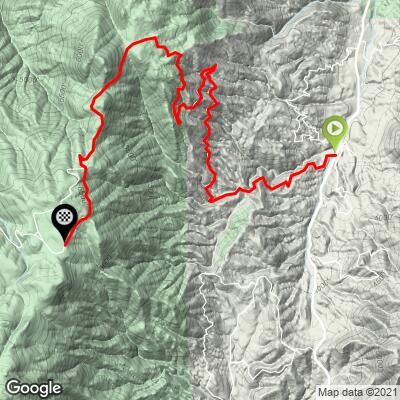
ROUTE MAP
MEMBER RATING
CURRENT WEATHER
PJAMM TRIPS ADVENTURE STARTER BUNDLES
Check out PJAMM Adventure's prepackaged (self-guided) cycling trips. They will help you plan, document and conquer your next adventure.
NEARBY CLIMBS (0) RADIAL PROXIMITY
FROM No Climbs Found
MEMBER REVIEWS & COMMENTS
Let us know what you thought of this climb. Signup for our FREE membership to write a review or post a comment.
Already have an account?
LOG IN HERE