4.6
PDI
1.1 mi
DISTANCE
586 ft
GAINED
9.8 %
AVG. GRADE
FULL CLIMB STATS
Page Contributor(s): Dan Razum, San Jose, CA; Patrick Merrill, South Bound Brook, NJ, USA
INTRO
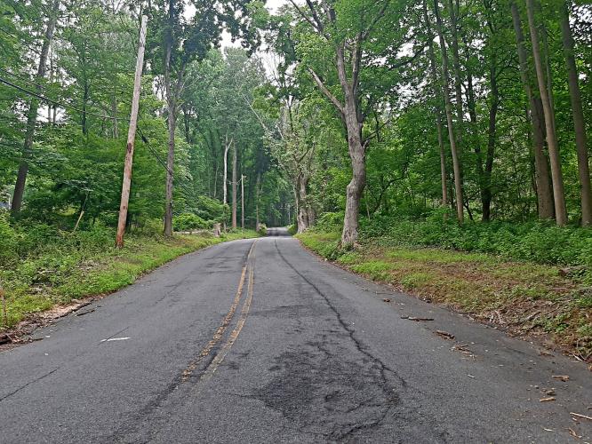
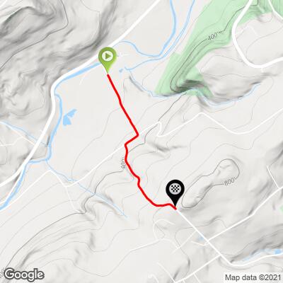
This 1.1 mile bike climb is located in NJ, USA. The average gradient is 9.8% and there is a total elevation gain of 586 ft, finishing at 806 ft.
Use the profile tool, route map, and weather forecast to conquer this cycling climb.
Use the profile tool, route map, and weather forecast to conquer this cycling climb.
PLAN YOUR ROUTE
See more details and tools regarding this climb's grade via our interactive Profile Tool.
Information Not Available
If you have any information regarding this climb, we'd like to hear from you. Click the CONTRIBUTE button to share your thoughts with us.
Information Not Available
If you have any information regarding this climb, we'd like to hear from you. Click the CONTRIBUTE button to share your thoughts with us.
Before heading out on any cycling adventure check out our Things to Bring on a Cycling Trip and use our interactive check list to ensure you don't forget anything.
Information Not Available
If you have any information regarding this climb, we'd like to hear from you. Click the CONTRIBUTE button to share your thoughts with us.
ROUTE MAP
MEMBER RATING
CURRENT WEATHER
PJAMM TRIPS ADVENTURE STARTER BUNDLES
Check out PJAMM Adventure's prepackaged (self-guided) cycling trips. They will help you plan, document and conquer your next adventure.
NEARBY CLIMBS (0) RADIAL PROXIMITY
FROM No Climbs Found
MEMBER REVIEWS & COMMENTS
Let us know what you thought of this climb. Signup for our FREE membership to write a review or post a comment.
Already have an account?
LOG IN HERE
DrJoeB
Cyphers is merely an appetizer before the main course, Shire. It's challenging, but there are less steep sections to catch your breath. Toughest part is the very top. The most difficult parts are shaded and go through the forest. Tip: there's no road sign at the start of Shire. After summiting, descend Shire and at the T, go right onto Church and take that to the first right, Amsterdam. The next right is Alfalfa Hill. This is a moderate, forested climb that leads to a reall fun, fast technical descent with several tight turns. Hard stop at bottom (Mt Joy).