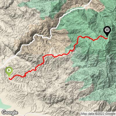
Breckenridge Road West Bike Climb - PJAMM Cycling

9.4
FIETS
23.8 mi
DISTANCE
6,337 ft
GAINED
4.7 %
AVG. GRADE

FULL CLIMB STATS

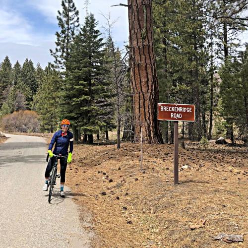
Page Contributor(s): Lisa Irizarry, NY, NY

INTRO

This 23.8 mile bike climb is located in CA, USA. The average gradient is 4.7% and there is a total elevation gain of 6,337 ft, finishing at 6,663 ft.

Use the profile tool, route map, and weather forecast to conquer this cycling climb.

See more details and tools regarding this climb's grade via our interactive Profile Tool.
Information Not Available

If you have any information regarding this climb, we'd like to hear from you. Click the CONTRIBUTE button to share your thoughts with us.

Information Not Available

If you have any information regarding this climb, we'd like to hear from you. Click the CONTRIBUTE button to share your thoughts with us.

Before heading out on any cycling adventure check out our Things to Bring on a Cycling Trip and use our interactive check list to ensure you don't forget anything.
Information Not Available

If you have any information regarding this climb, we'd like to hear from you. Click the CONTRIBUTE button to share your thoughts with us.

ROUTE MAP

MEMBER RATING

Difficulty: Challenging
4
Road
5
Traffic
4
Scenery

CURRENT WEATHER

PJAMM TRIPS ADVENTURE STARTER BUNDLES

Check out PJAMM Adventure's prepackaged (self-guided) cycling trips. They will help you plan, document and conquer your next adventure.
ALL TRIPS
Browse all of our prepackaged trips and find your next adventure!
Sequoia and Kings Canyon
United States (CA)
15 ROUTES
11 POIs
ROUTE STATS (TOTAL)
281
mi
DISTANCE
77,122
ft
ELEV. GAIN

NEARBY CLIMBS (0) RADIAL PROXIMITY

FROM
No Climbs Found

MEMBER REVIEWS & COMMENTS

Let us know what you thought of this climb. Signup for our FREE membership to write a review or post a comment.
Already have an account?

Apr 27, 2021
difficulty: Challenging
scenery: 4
traffic: 5
road: 4
Apr 27, 2021
scenery: 4
traffic: 5
road: 4
What more can you ask for? No cars awesome desert like sand dune scenery which turns to open range cattle and ultimately wooded. Almost no cars and decent pavement with spotted broken pavement in a few spots. 5 cattle guards to cross. Must do if in the area and closest climb from downtown Bakersfield but be cognizant that it is a long climb and you are out in the open for the first 13 or so miles so if the sun is out you will need more than two water bottles. Over prepare with food and water as there is absolutely nothing out there for the entire climb.
ROUTE MAP
PROFILE TOOL
Route Data
S.G. (%)
hide
Segment Data
hide

Climb Profile Not Found
CLIMB SUMMARY

Cycling Breckenridge West, California - cyclist on bike in center of wide winding roadway, mountains in distance. all of photo is black and white except for cyclist's red jersey and red helmet

Cycling Breckenridge West, California

Ride 24.6 miles gaining 5,950’ at 4.1% average grade (5.5% climb only)

Cycling Breckenridge West, California - photo collage, PJAMM Cycling logo in corner, cyclist on various portions of roadway along the climb, alpine setting, pastureland

This climb begins just 12 miles outside of Bakersfield, CA and is much more gradual in grade, but three times longer in length, than the east side of the pass.  One very scenic (if not epic) part of this climb is the lower quarter which takes us through rolling hills surrounded by nothing more than Southern Sierra grasslands and the view back from around miles 2-6 is simply unique and spectacular.  The smooth topography void of any trees or vegetation other than high brown grass gives the impression of being in the Sahara Desert’s sand dunes, rather than barren hills covered only with grass (see photos - extremely unique scenes).  


Cycling Breckenridge West, California - views along the route, Southern Sierra grasslands, hilltops covered in brown grasses

There are no provisions along this route and it gets extremely hot during the late spring and summer, so bring two water bottles and a good size hydration pack and extra food.  The climb ends at unmarked Breckenridge Pass and the more adventurous (nutty?) of us will drop down the east side of Breckenridge Mountain and ride back up Breckenridge East.  Doing this is a very difficult and risky proposition as there is no place for water in this nearly 100 mile trek if you begin in Bakersfield (or 70 miles if you park at the start of Breckenridge West climb).  

Cycling Breckenridge West, California - pastureland views along the climb, brown hilltops covered in brown grass

Roadway Surface and Traffic Report:  Narrow two lane road with no center stripe for the first portion of the climb, turning to a narrow and twisty wide one lane road over the last third of the climb.  There is minimal traffic on this climb.

Cycling Breckenridge West, California - Cyclist Lisa Irizarry stands on bike next to sign for Breckenridge Road, alpine setting, pine trees

Thank you Lisa Irizarry!!

Access to full Climb Summary requires a PJAMM Cycling PRO Membership!

It takes less than a minute to sign up & with your PRO membership you can:
  • Rate climbs, post comments and share your experiences on any of our climb pages
  • Create bucket lists of climbs & mark the dates you complete them
  • Weather data for all climbs - Start & Finish
  • Upload photos to your member page to customize your PJAMM Cycling experience
  • Utilize all of our interactive tools - Profile & Routes in Area
  • Download climb route .gpx files
LEARN MORE
SIGN UP

Already have an account? LOG IN HERE