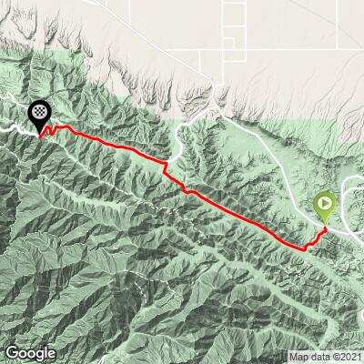
23.7
PDI
15.8 mi
DISTANCE
4,443 ft
GAINED
4.9 %
AVG. GRADE
FULL CLIMB STATS
INTRO
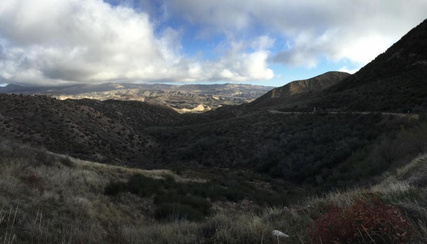
This climb begins on the eastern side of the San Gabriel Mountains (Angeles National Forest) and travels 10 miles to the very quaint alpine town of Wrightwood (which can be used as base camp for some epic Southern California climbs – more on that below).
PLAN YOUR ROUTE
See more details and tools regarding this climb's grade via our interactive Profile Tool.
Information Not Available
If you have any information regarding this climb, we'd like to hear from you. Click the CONTRIBUTE button to share your thoughts with us.
Information Not Available
If you have any information regarding this climb, we'd like to hear from you. Click the CONTRIBUTE button to share your thoughts with us.
Before heading out on any cycling adventure check out our Things to Bring on a Cycling Trip and use our interactive check list to ensure you don't forget anything.
Information Not Available
If you have any information regarding this climb, we'd like to hear from you. Click the CONTRIBUTE button to share your thoughts with us.
ROUTE MAP
MEMBER RATING
CURRENT WEATHER
PJAMM TRIPS ADVENTURE STARTER BUNDLES
Check out PJAMM Adventure's prepackaged (self-guided) cycling trips. They will help you plan, document and conquer your next adventure.
NEARBY CLIMBS (0) RADIAL PROXIMITY
FROM No Climbs Found
MEMBER REVIEWS & COMMENTS
Let us know what you thought of this climb. Signup for our FREE membership to write a review or post a comment.
Already have an account?
LOG IN HERE
Noseycoors


Great climb. The first 7 miles are perfect roads (especially fun on the way back down). Pavement a touch rough between wrightwood and mountain high but not terrible. First 7 miles are the toughest IMO. Long steady climb and the higher percentages...plus you can see the climb in front of you forever! View on top of blue ridge summit is worth it all! Stunning