![]()
Cycling Valdresflye (Valdresflya) North
Ride 10.4 kilometers gaining 427 meters at 4% average grade.
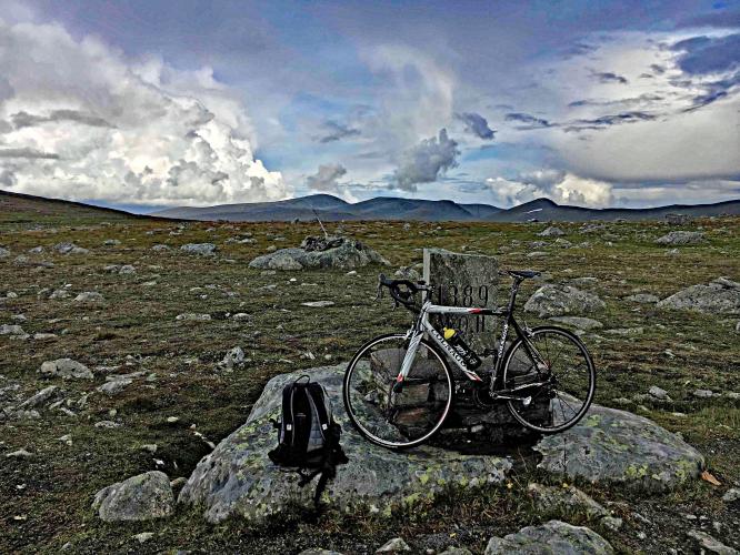
This climb takes us on a remote journey along to Steinplassen which is home to “Rock on Top of Another Rock”.
![]()
Photos: Nasjonale Turistveger - Norwegian Scenic Routes
This climb is along one of the 18 Scenic Routes of Norway:
“Driving in the open sweep of the landscape can be compared with the feeling of flying. The road swoops and stretches out ahead in long sweeps of undulating terrain. It’s easy to let your thoughts soar to the heights of the mountains on the horizon. The natural surroundings are both alluring and within reach, and the road hugs the landscape as a secure mooring. The landscape can appear drowsy and friendly but the road is closed in the winter for good reasons. When winter tightens its icy clutch and remorseless winds sweep over the plateau, the huge snow masses make the task of keeping the road open too demanding. When everything is bathed in light in the summer there are no dark shadows. Regardless of where you stop you don’t need to go far before feeling you’re on an expedition. The open landscape needs little human intervention, and the rest areas and art works blend into the background and draw your attention to individual features. Valdresflye forms a composite picture rather than presenting hidden secrets. Serenity is the dominating quality in the experience of this vast landscape. . . .
Cycling
Up on Valdresflye you get the feeling of “hovering” above the mountain plateau with a great view towards many of the mountain peaks of Jotunheimen National Park. Remember that large open areas up in the mountains also mean strong winds. Whether you come from the north or the south we recommend a detour (2 km) to the beautiful Lake Gjende, which is a good point of departure for a number of walks. On Valdresflye there is a good deal of traffic and a few long climbs, but the cycle ride is absolutely manageable.
In time, this route will be part of National Cycle Route No. 5. . . .”
Nasjonaleturistveger.no
![]()

 We've partnered with Sherpa-Map.com to bring you the best route planning tool. With a PRO Membership you can use this climb as a reference when creating your route.

