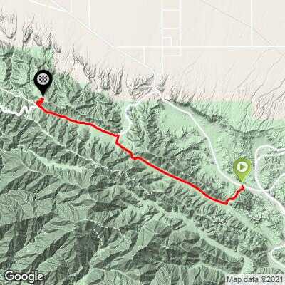
25.1
PDI
15.3 mi
DISTANCE
4,511 ft
GAINED
5.2 %
AVG. GRADE
FULL CLIMB STATS
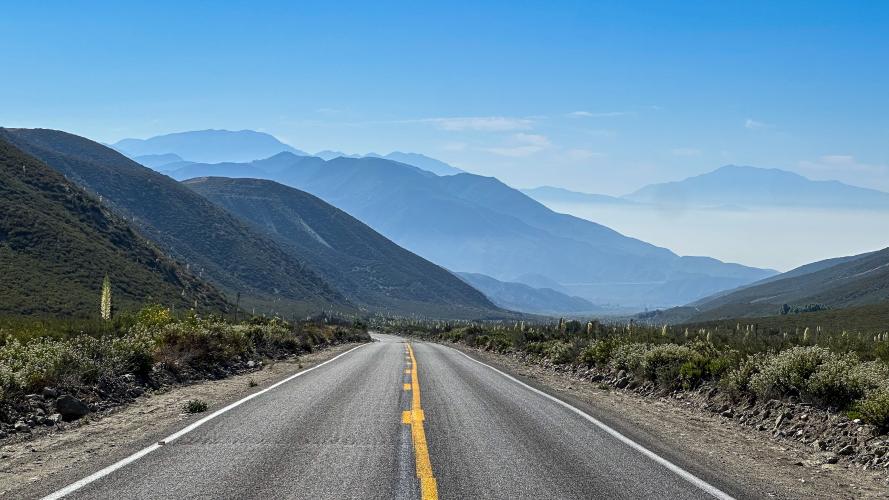
INTRO
Long, long and straight. This one is almost as much of a mental battle as it is a physical one. The views, fresh mountain air, and the final ascent to Table Mountain are rewarding!
"From just west of Interstate 15 head up Route 138 along a shallow grade to begin the climb. At mile 1.0 turn left on Lone Pine Canyon Road. Follow this very scenic section to the town of Wrightwood, making several turns once in town to end up at Route 2 (Angeles Crest Highway). Turn left on Route 2 and climb for 4 miles to the junction with N4 (on the right). At that junction turn right (just before you reach N4) to climb up to Table Mountain where the ascent ends at the top of a parking area." - John Summerson, The Complete Guide to Climbing (by Bike), 2nd Edition)
PLAN YOUR ROUTE
See more details and tools regarding this climb's grade via our interactive Profile Tool.
Roadway:
The road surface is excellent for the entirety of the climb. Parking:
Ample roadside parking near the start of the climb,
Traffic:
Traffic is very light, but can be very fast moving - however you can hear a car approaching for miles.
Several restaurants, coffee shops, and convenience stores in the sleepy mountain town of Wrightwood halfway through the climb. Wrightwood Brewing is one of our all time favorites!
Before heading out on any cycling adventure check out our Things to Bring on a Cycling Trip and use our interactive check list to ensure you don't forget anything.
ROUTE MAP
MEMBER RATING
CURRENT WEATHER
PJAMM TRIPS ADVENTURE STARTER BUNDLES
Check out PJAMM Adventure's prepackaged (self-guided) cycling trips. They will help you plan, document and conquer your next adventure.
NEARBY CLIMBS (0) RADIAL PROXIMITY
FROM No Climbs Found
MEMBER REVIEWS & COMMENTS
Let us know what you thought of this climb. Signup for our FREE membership to write a review or post a comment.
Already have an account?
LOG IN HERE