![Cycling Malibu Canyon Road to the top of Piuma Road Cycling Malibu Canyon Road to the top of Piuma Road - bike parked on roadside next to sign for Malibu]()
Cycling Malibu Canyon Road to the top of Piuma Road
Santa Monica Mountains, California
Ride 10 miles gaining 2,500’ at 4% average grade.
![Cycling Malibu Canyon Road to the top of Piuma Road Cycling Malibu Canyon Road to the top of Piuma Road - photo collage, sign for Malibu, tunnel in stone wall, cyclist on stretch of two-lane mountain roadway, sign for Pepperdine University, Santa Monica Mountains]()
The first 4.6 miles of this climb are along busy Malibu Canyon Road (County Route N1, which connects PCH to Highway 101). At mile 4.6 turn right onto Piuma Road, one of the best Santa Monica Mountains climbs that doesn’t begin on the Pacific Coast Highway. For those traffic averse, consider beginning the climb at Piuma Road.
![]()
![]()
![]()
Warning: There is a nearly 200 yard tunnel beginning at mile 3.6 so be sure to bring tail lights.
![Cycling Malibu Canyon Road to the top of Piuma Road Cycling Malibu Canyon Road to the top of Piuma Road - intersection, road signs for Malibu Canyon Road]()
Start in Malibu and ride up Malibu Canyon Road past Pepperdine University.
![Cycling Malibu Canyon Road to the top of Piuma Road Cycling Malibu Canyon Road to the top of Piuma Road - cross atop Pepperdine University seen from Malibu Canyon Road]()
Cross at Pepperdine University as seen from Malibu Canyon Road
![Cycling Malibu Canyon Road to the top of Piuma Road Cycling Malibu Canyon Road to the top of Piuma Road - signs for Piuma Road]()
Turn right onto Piuma Road at mile 4.6.
![Cycling Malibu Canyon Road to the top of Piuma Road Cycling Malibu Canyon Road to the top of Piuma Road - two lane mountain roadway, Santa Monica Mountain peaks beyond, PJAMM Cyclist on roadway]()
Riding up Piuma just before one of the three big hairpins -- mile 7.3
![Cycling Malibu Canyon Road to the top of Piuma Road Cycling Malibu Canyon Road to the top of Piuma Road - views along the climb, Malibu Canyon and Malibu Canyon Road, Santa Monica Mountains]()
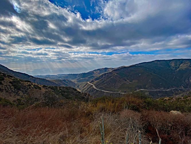
Views along the Piuma Road climb.
Upper photo: View southwest of Malibu Canyon and Malibu Canyon Road from mile 8.1
![Cycling Malibu Canyon Road to the top of Piuma Road Cycling Malibu Canyon Road to the top of Piuma Road - view looking down canyon, bike leaning against guardrail, Santa Monica Mountains]()
View from tip of hairpin at mile 7.5
Left photo: View southwest; Right photo: view northwest.
![Cycling Malibu Canyon Road to the top of Piuma Road Cycling Malibu Canyon Road to the top of Piuma Road - PJAMM Cyclist rides on giant hairpin turn just below David M. Brown overlook, Santa Monica Mountians]()
Five perspectives of the giant hairpin just below David M. Brown Overlook.
![Cycling Malibu Canyon Road to the top of Piuma Road Cycling Malibu Canyon Road to the top of Piuma Road - aerial view of hairpin turn, bike parked against sign for David M. Brown overlook, Santa Monica Mountains]()
Overlook at mile 7.6.
“Balanced on the narrow spine of Piuma Ridge, the popular David M. Brown Overlook affords prime views and many distant glimpses of the 110-square-mile Malibu Creek watershed. This includes Malibu Creek State Park, 588-acre King Gillette Ranch, and portions of the 65-mile-long Backbone Trail, all of which conservationist David M. Brown had a significant role in preserving as public parkland,” (MRCA).
The overlook was dedicated to David M. Brown after his death in 2013. Mr. Brown played a key role in preserving the Santa Monica Mountains. Read the LA Times tribute to David MacNeille Brown here.
![Cycling Malibu Canyon Road to the top of Piuma Road Cycling Malibu Canyon Road to the top of Piuma Road - bike parked against informational signs at David M. Brown Overlook in Santa Monica Mountains, Santa Monica Mountains]()
![Cycling Malibu Canyon Road to the top of Piuma Road Cycling Malibu Canyon Road to the top of Piuma Road - aerial drone views of the David M. Brown Overlook and the hairpin turn that borders it, Santa Monica Mountains]()
Aerial views of David M. Brown Overlook and the hairpin that borders it.
![Cycling Malibu Canyon Road to the top of Piuma Road Cycling Malibu Canyon Road to the top of Piuma Road - climb finish, two lane roadway, W. Saddle Peak Road on the left]()
Climb finish -- W. Saddle Peak Road to the left.
HOW TO GET FROM CLIMB TO CLIMB ALONG THE PCH
![Cycling Malibu Canyon Road to the top of Piuma Road Cycling Malibu Canyon Road to the top of Piuma Road - Google Maps aerial view of Pacific Coast Highway, Santa Monica Mountains]()
![Cycling Malibu Canyon Road to the top of Piuma Road Cycling Malibu Canyon Road to the top of Piuma Road - Google Maps aerial view of Pacific Coast Highway, Santa Monica Mountains]()

 We've partnered with Sherpa-Map.com to bring you the best route planning tool. With a PRO Membership you can use this climb as a reference when creating your route.

