13.2
PDI
5.2 mi
DISTANCE
2,059 ft
GAINED
7.3 %
AVG. GRADE
FULL CLIMB STATS
Page Contributor(s): Daniel Patrick, Los Angeles, CA, USA
INTRO
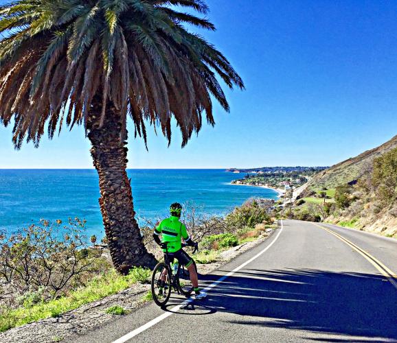
This is a fun climb beginning at PCH and continuing 5.3 miles to a dead end and trail head. The climb is quite challenging at 6.9% average grade (1/4 mile at 15% and 1/2 mile at 13%). There are great views along this climb.
PLAN YOUR ROUTE
 We've partnered with Sherpa-Map.com to bring you the best route planning tool. With a PRO Membership you can use this climb as a reference when creating your route.
 See more details and tools regarding this climb's grade via our interactive Profile Tool.
Information Not Available
If you have any information regarding this climb, we'd like to hear from you. Click the CONTRIBUTE button to share your thoughts with us.
Information Not Available
If you have any information regarding this climb, we'd like to hear from you. Click the CONTRIBUTE button to share your thoughts with us.
Before heading out on any cycling adventure check out our Things to Bring on a Cycling Trip and use our interactive check list to ensure you don't forget anything.
Want to ride with us in the Santa Monica Mountains? Join us in Malibu on one of our all-new PJAMM Guided Cycling Tours launching this fall.
Current Tour Dates:
ROUTE MAP

MEMBER RATING
CURRENT WEATHER
PJAMM TRIPS ADVENTURE STARTER BUNDLES
Check out PJAMM Adventure's prepackaged (self-guided) cycling trips. They will help you plan, document and conquer your next adventure.
NEARBY CLIMBS (0) RADIAL PROXIMITY
FROM No Climbs Found
MEMBER REVIEWS & COMMENTS
Let us know what you thought of this climb. Signup for our FREE membership to write a review or post a comment.
Already have an account?
LOG IN HERE
joelmblatt
Scenery is awesome at end of descending. At end of pavement ascent, you can continue on dirt. Steeps begin in earnest, then taper off.
zross
This is my favorite of the tough SMM climbs (Las Flores, Deer Creek). It gets quite steep in the first third or so; my Hammerhead has it peaking in the 18% range not too far before the first big switchback. The views on the way down are awesome and at one point you're riding down a ridge with views of the ocean on both sides of you. The only downside to this climb is there is absolutely no shade and in the summer it can get brutally hot.
Tinypip
The steepest part hits you very early, which makes pacing a challenge, but the end is much more enjoyable. Traffic is very light, I often do this before sunrise with lights and it feels pretty safe.

