![Cycling Mulholland Highway from Pacific Coast Highway Cycling Mulholland Highway from Pacific Coast Highway - photo collage, cyclist rides on two-lane roadway with large rocks and desert landscape, bike parked in tall grass on hillside on side of road, Santa Monica Mountains]()
Cycling Mulholland Highway from Pacific Coast Highway
Santa Monica Mountains, California
Ride 6.9 miles gaining 1,632’ at 4.1% average grade.
This famous and scenic highway runs about 50 miles from PCH through the Santa Monica Mountains to Calabasas near US 101. This climb (but not all of Mulholland Highway) is included in the California Scenic Highway System and a substantial section of the highway passes through “memorable landscape” with no visual intrusions.
![Cycling Mulholland Highway from Pacific Coast Highway Cycling Mulholland Highway from Pacific Coast Highway - historic black and white photos of Mulholland Highway in the 1920s]()
Mulholland Highway was constructed in the 1920’s as a route for Angelinos to the Pacific Ocean.
The first segment of this climb is from the Pacific Coast Highway (Highway 1) up Mulholland to Little Sycamore Canyon Road. This section is closed to vehicle traffic due to the Woolsey Fire of November 2018. As of December 2020, the LA County Road Closures website advises that the date this section of roadway will be opened is “TBD.” Bicycles are permitted on this segment which makes it an even more glorious Santa Monica Mountains cycling jewel.
The standard Mulholland Highway climb ends at its intersection with Little Sycamore Canyon Road. To complete one of the hardest and highest climbs in the Santa Monica Mountains, turn left on Little Sycamore Canyon Road and ride another 2.8 miles at 5% to the high point which is on Yerba Buena Road (Little Sycamore changes to Yerba Buena near the middle of this segment).
![Cycling Mulholland Highway from Pacific Coast Highway Cycling Mulholland Highway from Pacific Coast Highway - bike parked against stop sign at intersection of Mulholland Highway and Little Sycamore Canyon Road]()
Left on Little Sycamore Canyon Road at mile 6.9.
![Cycling Mulholland Highway from Pacific Coast Highway Cycling Mulholland Highway from Pacific Coast Highway - highway road climbing up hillside, blue sky, high desert landscape, Santa Monica Mountains]()
Views along the 1.8 mile ridge segment of the climb at 5.6%.
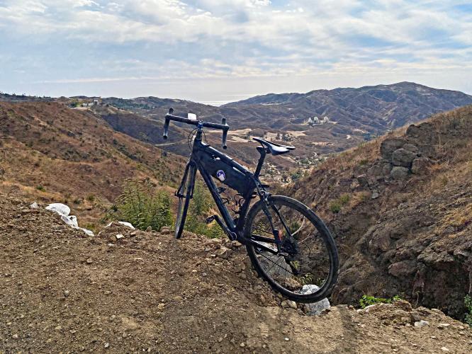
![Cycling Mulholland Highway from Pacific Coast Highway Cycling Mulholland Highway from Pacific Coast Highway - bike parked on mountain side overlooking the Triunfo Pass Earth Satellite Station, Santa Monica Mountains]()
Triunfo Pass Earth Satellite Station as seen from mile 7.6 looking south.
Triunfo Pass is located on Yerba Buena Road about a mile past the completion of our route.
![Cycling Mulholland Highway from Pacific Coast Highway Cycling Mulholland Highway from Pacific Coast Highway - bike parked on roadside against sign for Yerba Buena Road and Little Sycamore Canyon Road, Santa Monica Mountains]()
Little Sycamore changes to Yerba Buena Road at mile 8.4.
![Cycling Mulholland Highway from Pacific Coast Highway Cycling Mulholland Highway from Pacific Coast Highway - aerial drone photo overlooking Santa Monica Mountains, Yerba Buena Road and Little Sycamore Roads can be seen in middle of the photo]()
![Cycling Mulholland Highway from Pacific Coast Highway Cycling Mulholland Highway from Pacific Coast Highway - bike parked under tree in brief alpine setting at the end of mountain ridgeline]()
There is a brief alpine setting at the end of the ridgeline -- mile 8.8.
![Cycling Mulholland Highway from Pacific Coast Highway Cycling Mulholland Highway from Pacific Coast Highway - PJAMM Cyclist riding on roadway at high point of Yerba Buena Road]()
Finish at the high point of Yerba Buena Road.
This is the highest paved roadway point in the Santa Monica Mountains.
![Cycling Mulholland Highway from Pacific Coast Highway Cycling Mulholland Highway from Pacific Coast Highway - Sandstone Peak, the highest point in the Santa Monica Mountains, as seen from ride finish]()
The Santa Monica Mountains high point, Sandstone Peak (3,114’), as seen from the finish of our climb.

 We've partnered with Sherpa-Map.com to bring you the best route planning tool. With a PRO Membership you can use this climb as a reference when creating your route.

