
25.2
PDI
16.8 mi
DISTANCE
4,899 ft
GAINED
5 %
AVG. GRADE
FULL CLIMB STATS
Page Contributor(s): Ard Oostra, Montreux, Switzerland
INTRO
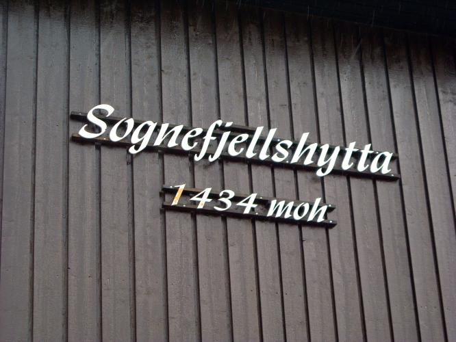
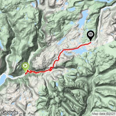
Sognefjellhytta sits at the top of Sognefjellsvegen (Route 55), the highest paved mountain-pass road in Northern Europe, cresting near 1434 m (4,705 ft) at the Fantesteinen viewpoint just above the mountain lodge this climb is named for. From Fortun, at the head of the Lustrafjord, our route climbs 27.1 km (16.8 mi) and gains 1,493 m (4,899 ft) at an average grade of 5.0%.
The ride is a complete transect of western Norway's landscape - from the emerald-green Lustrafjorden, up through birch forest and past Turtagrø, the historic hotel regarded as the birthplace of Norwegian mountaineering, then above the treeline into the stark, glacier-rimmed high country of Jotunheimen National Park, with views of Fannaråken, Smørstabbtindane and the Hurrungane massif.
Sognefjellsvegen opened in 1938 along a route used for centuries as a trading and pilgrim path across the mountains between the fjords and the Gudbrandsdalen valley; today it's one of Norway's official National Tourist Routes ("Nasjonale Turistveger").
The pass is closed by snow in winter, typically reopening in April with a nightly closure (8pm-8am) until the road is fully cleared by late May, and closing again by early November - check current road status before planning a trip. Given the exposed, high-altitude finish, check current conditions before you go with our Weather tool.
PLAN YOUR ROUTE
 We've partnered with Sherpa-Map.com to bring you the best route planning tool. With a PRO Membership you can use this climb as a reference when creating your route.
 Average grade is 5.0% over 27.1 km (16.8 mi), gaining 1,493 m (4,899 ft) with about 146 m (479 ft) of intermediate descent as the road dips near Turtagrø before continuing to climb toward the pass. The steepest 500 meters on the climb averages 11.2%.
Roadway: The road is paved the entire way as part of Norway's National Tourist Route network and is generally well maintained, though it narrows and winds through the upper alpine sections with no shoulder in most spots.
Traffic: This is a popular scenic drive, so expect a steady stream of cars and camper vans, especially in July and August; traffic is lightest early in the morning and outside the July-August peak.
Parking: Fortun is a small village at the head of the Lustrafjord with limited pull-offs near the start of Route 55; Turtagrø Hotel, roughly mid-route, and Sognefjellshytta lodge at the summit both have parking if you'd rather start or break the ride higher up.
Provisions: There's nothing between Fortun and the summit besides two staffed stops directly on the route - Turtagrø Hotel, the historic mountaineering hotel roughly mid-climb, and Sognefjellshytta itself at the top - both of which offer food and water refills for cyclists.
Gear: The finish sits above 1,300 m in exposed, glacier-rimmed terrain where weather can turn quickly even in summer - pack a wind/rain layer and something warm for the descent, regardless of how warm it is down at the fjord.
Before heading out on any cycling adventure check out our Things to Bring on a Cycling Trip and use our interactive check list to ensure you don't forget anything.
Sognefjellshytta and the surrounding Jotunheimen high country are also a major hiking and glacier-travel hub - the lodge is a common starting point for guided trips up Fannaråken, Smørstabbtindane and other peaks in the Hurrungane massif if you want to extend your stay.
The pass is only open to cyclists roughly from April/May through early November and is closed and often impassable with snow the rest of the year, so plan for summer and double-check current road status before you go.
ROUTE MAP
MEMBER RATING
CURRENT WEATHER
PJAMM TRIPS ADVENTURE STARTER BUNDLES
Check out PJAMM Adventure's prepackaged (self-guided) cycling trips. They will help you plan, document and conquer your next adventure.
NEARBY CLIMBS (0) RADIAL PROXIMITY
FROM No Climbs Found
MEMBER REVIEWS & COMMENTS
Let us know what you thought of this climb. Signup for our FREE membership to write a review or post a comment.
Already have an account?
LOG IN HERE
