24
PDI
15.8 mi
DISTANCE
4,462 ft
GAINED
5.4 %
AVG. GRADE
FULL CLIMB STATS
Page Contributor(s): Ken Read, Canmore, Alberta, CAN; Lynn Sugden, Alberta, Canada.
INTRO
This gorgeous climb begins on Summit Road at the outskirts of Revelstoke, BC just off Highway 1 (Trans-Canada Highway). This is the #2 climb in Canada and is situated generally in the center of the top Canadian climbs which are predominantly located in the southern portion of Canada’s westernmost province, British Columbia, at the confluence of the Illecillewaet and Columbia Rivers at the north end of the Arrow Lakes.
PLAN YOUR ROUTE
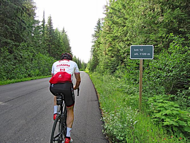
This one is 25 kilometers at a fairly steady 5.4% average grade with no appreciable flats or descents along the way. 41% (10.4 km) of the climb is at 0-5% grade, and 59% (14.9 km) is at 5-10%. No part of this climb exceeds 10% grade. The steepest 500 meters is 9% and steepest continuous kilometer 7.5%.
See more details and tools regarding this climb's grade via the “Profile Tool” button.
Roadway: Excellent condition and in the National Park from the just after the start.
Traffic: Mild and respectful - this is a safe climb.
Parking: At a trailhead parking lot 50 meters up the hill from climb start - Map; Street View.
There are no provisions along this route.
Before heading out on any cycling adventure check out our Things to Bring on a Cycling Trip and use our interactive check list to ensure you don't forget anything.
We stayed in Revelstoke when we did this climb. There are many vacation rentals in the area along the Columbia River. You may also wish to hike on some of the wonderful trails in Revelstoke National Park.
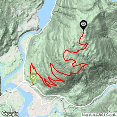
ROUTE MAP
MEMBER RATING
CURRENT WEATHER
PJAMM TRIPS ADVENTURE STARTER BUNDLES
Check out PJAMM Adventure's prepackaged (self-guided) cycling trips. They will help you plan, document and conquer your next adventure.
NEARBY CLIMBS (0) RADIAL PROXIMITY
FROM No Climbs Found
MEMBER REVIEWS & COMMENTS
Let us know what you thought of this climb. Signup for our FREE membership to write a review or post a comment.
Already have an account?
LOG IN HERE
TobyGadd
Fantastic! Beautiful views, super-smooth road, courteous Canadian drivers, and a solid climb. What's not to love!
trier1992
Probably the smoothest road I've ever ridden in a national park in Canada or the US, essentially perfect, which lead to a fantastic descent. Beautiful everywhere a must if you're in the area.
bikeage


A classic European climb in Canada, though one way.
Didn't have to pay in August, 2021.