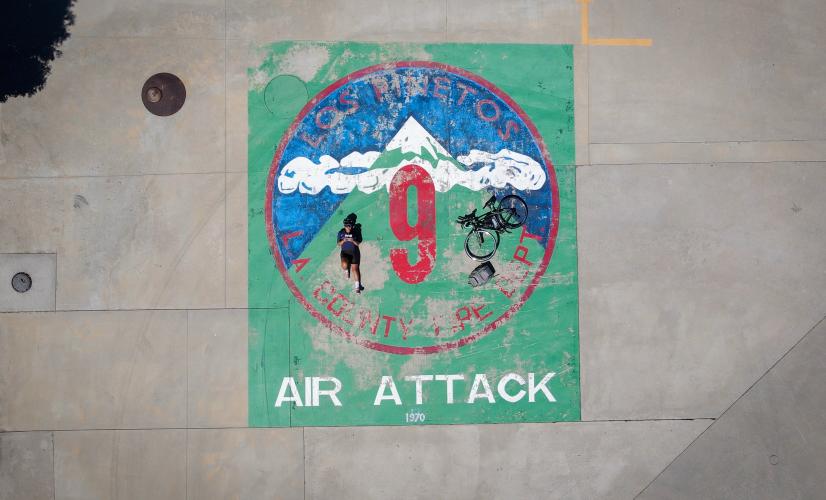
Camp 9 - an extremely popular climb up to a Los Angeles County fire station.
![]()
We started out at around 7am on a Saturday in late June, which ended up being a bit too late - the temp reached 95 in the afternoon. The start of this climb is unimpressive, beginning at the bottom of the valley between Dillon Divide and Bear Divide.
Riding north takes you up this climb, and riding south from this point will take you up to Dillon Divide, the Little Tujunga West Climb.
![]()
The climb starts to become more scenic once you reach Bear Divide, the second saddle on Little Tujunga Canyon Road between San Fernando and Santa Clarita. Both saddles are at almost exactly the same elevation (Dillon Divide 2,754ft; Bear Divide 2,725ft)
![]()
![]()
Looking up you can see the cliff where the road is cut into the mountain:
![]()
![]()
This is where you pass a ranger station with a water spicket. The only other water in the area is at the top of the climb, Camp 9 Fire Station.
![]()
The road quality is surprisingly good on this climb. It’s maintained for the fire trucks; Camp 9 is the primary Fire Station for the western San Gabriel mountains, an area very prone to forest fires in the summer.
![]()
You encounter very little shade along this climb. There is a small grove of trees during the final mile approaching the Fire Station, but otherwise the entire climb is exposed. There’s also plenty of shade at the actual station, great places to sit, rest and refill water bottles:
![]()
![]()
The Firefighters are incredibly friendly and always willing to help you out if you need water, supplies, etc. When not fighting fires, they take their pickleball tournaments very seriously!
![]()
![]()
The climb continues after the fire station - the steepest part: 1/3 mile at 10.1%. The gradient peaks at around 14.1%
![]()
![]()
![]()
![]()
As usual, the hardest part also yields the best views…
![]()
![]()
![]()
That’s a wrap!
![]()
![]()

 We've partnered with Sherpa-Map.com to bring you the best route planning tool. With a PRO Membership you can use this climb as a reference when creating your route.

