
24
PDI
3.4 mi
DISTANCE
2,354 ft
GAINED
13.1 %
AVG. GRADE
FULL CLIMB STATS
Page Contributor(s): Nick Payne, Canberra, Australia
INTRO
Mostelegg is a 1266 m (4,154 ft) grassy saddle in the Schwyz pre-Alps, between the town of Schwyz and the Sattel-Hochstuckli area, and the road up from Schwyz ranks among the steepest sustained climbs in Switzerland. It covers just 5.5 km (3.4 mi) but gains 717 m (2,354 ft) at an average of 13.1% - and there is no let-up: every kilometer split averages between 11.7% and 14.1%.
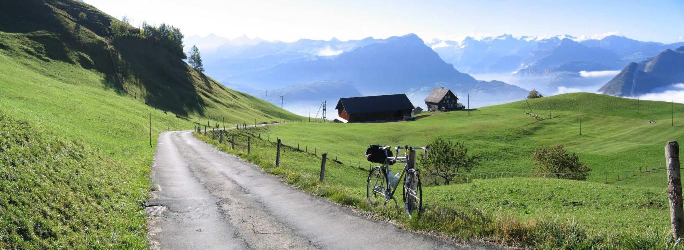
This is a minor road serving the farms above Schwyz, not a through-route. It leaves the edge of Ibach and heads straight up the hillside above the Nietenbach, sharing its lower slopes with the even more notorious Haggenegg climb before branching off toward Mostelegg past a scattering of farmhouses. The reward at the top is a sweeping panorama: the rock towers of the Grosser and Kleiner Mythen close at hand, with views on to the pyramid of the Bristen and the Rigi. The meadows at the saddle are also used as a launch site by hang gliders.
Short as it is, this is a climb for strong legs and low gears - expect to spend nearly all of it well into double digits. From the top you can drop down the gentler far side toward Mostelberg and Sattel, or pair it with the other hard climbs out of Schwyz for a punishing morning in the pre-Alps.
PLAN YOUR ROUTE
 We've partnered with Sherpa-Map.com to bring you the best route planning tool. With a PRO Membership you can use this climb as a reference when creating your route.
 Mostelegg from Schwyz climbs 5.5 km (3.4 mi) and gains 717 m (2,354 ft) at an average of 13.1%, from 549 m (1,801 ft) in Ibach to 1266 m (4,154 ft) at the saddle.
There are no easy sections. Kilometer by kilometer the climb averages 11.7%, 13.1%, 13.4%, 13.8% and 13.2%, followed by 14.1% for the final 0.5 km (0.3 mi).
The steepest kilometer averages 14.4% and the steepest 2 km average 14.2%, with short ramps well beyond that - the steepest 100 m pitches are close to 20%.
Roadway: Paved to the top. This is a minor road - Nietenbachstrasse, then Riedstrasse - serving the farms and houses above Schwyz rather than a pass road, so expect a narrower lane and tighter corners than a typical Alpine climb. Climbing it is simply hard work; descending it demands real care, with 13-14% grades for kilometers on end, so keep your speed in check and watch for farm vehicles. Most riders tackle it between April and September.
Traffic: Very light. Beyond the first houses on the edge of Ibach, vehicles are mostly local farm and resident traffic, and the saddle itself is a quiet spot used mainly by hikers and hang gliders.
Parking: Schwyz station, on the Gotthard rail line in Seewen, is the natural starting point for this and the neighboring Haggenegg climb, and it has public parking; the start in Ibach is a short, gently rising ride away. Arriving by train is just as easy.
Gear: Gear low - a compact crankset with at least a 34-tooth cog, and a bigger one if your bike takes it. At a 13.1% average with pitches near 20%, most riders will be in their lowest gear from start to finish. Good brakes and fresh pads matter for the descent.
Provisions: Stock up in Schwyz before you start; there is nothing on the climb itself. Over the top, the Berggasthaus Mostelberg is about 2 km (1.2 mi) beyond the saddle on a gentle descent, serving regional dishes and homemade desserts with views over the Ägerital.
Before heading out on any cycling adventure check out our Things to Bring on a Cycling Trip and use our interactive check list to ensure you don't forget anything.
Schwyz is the town that gave Switzerland its name, and its Bundesbriefmuseum (Museum of the Swiss Charters of Confederation) houses the Federal Charter of 1291, the founding document of the Swiss Confederation - worth an hour before or after the ride. The twin peaks of the Mythen that fill the view from Mostelegg also dominate the town's skyline.
On the far side of the saddle, the Sattel-Hochstuckli area has a gondola, a summer toboggan run and the Raiffeisen Skywalk pedestrian suspension bridge - good options if you are traveling with family. For a harder day, the Haggenegg shares this climb's lower ramps and the Ibergeregg rises from the other side of Schwyz - see other climbs nearby, or build a custom route from here, with our Routes in the Area tool.
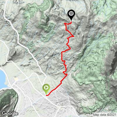
ROUTE MAP
MEMBER RATING
CURRENT WEATHER
PJAMM TRIPS ADVENTURE STARTER BUNDLES
Check out PJAMM Adventure's prepackaged (self-guided) cycling trips. They will help you plan, document and conquer your next adventure.
NEARBY CLIMBS (0) RADIAL PROXIMITY
FROM No Climbs Found
MEMBER REVIEWS & COMMENTS
Let us know what you thought of this climb. Signup for our FREE membership to write a review or post a comment.
Already have an account?
LOG IN HERE
NickPayne
Lovely consistently steep little climb out of Schwyz. Great views of the surrounding mountains. The descent down the other side towards Sattel is considerably less steep.
