23.9
PDI
17.8 mi
DISTANCE
4,733 ft
GAINED
4.8 %
AVG. GRADE
FULL CLIMB STATS
INTRO
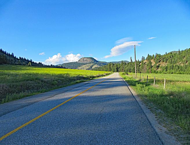
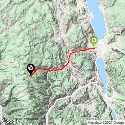
Wow! This is a sleeper climb. We did not expect to encounter such an exceptional ride when we originally researched and charted this one. This is a must-do for any cyclists in the Penticton area or traveling anywhere near it. While this climb begins in a weathered neighborhood, it immediately enters thickly wooded forest and follows a creek (not shown on the map, but it’s there!). Follow Green Mountain Road 18.5 kilometers then turn right for the final push up to Apex Mountain Resort.
PLAN YOUR ROUTE
Average grade is 4.8% (5.7% with descent eliminated from the equation). The crux of the climb is 9 kilometers at 14% beginning at kilometer 18.8. 30% (8.5 km) is at 5-10%, 12.2% (3.5 km) is at 10-15%, and 1% (0.3 km) is at 15-20%. The steepest 500 meters is 12.8% and steepest two kilometers 10.6%.
See more details and tools regarding this climb's grade via the “Profile Tool” button.
Roadway: Two lanes with center stripe. The pavement was in excellent condition in 2016.
Traffic: Minimal.
Parking: There is a parking area 0.4 miles before the climb start on the left - Map; Street View.
Provisions: There is no place to get food or water along the climb. It is possible that there could be something at the Apex Mountain Resort. Call the Gunbarrel Saloon just past the finish in advance if you would like a meal at the resort (250-292-8515).
Before heading out on any cycling adventure check out our Things to Bring on a Cycling Trip and use our interactive check list to ensure you don't forget anything.
A great out and back would be this climb + Apex from Hedley. Note that Apex from Hedley is all gravel so you would need to bring a gravel bike for this ride - 111 kilometers and 3,262 meters (Map).
There are several great resorts and hotels to choose from in Penticton to stay. Some travelers choose to rent a home or villa near the lake.
ROUTE MAP
MEMBER RATING
CURRENT WEATHER
PJAMM TRIPS ADVENTURE STARTER BUNDLES
Check out PJAMM Adventure's prepackaged (self-guided) cycling trips. They will help you plan, document and conquer your next adventure.
NEARBY CLIMBS (0) RADIAL PROXIMITY
FROM No Climbs Found
MEMBER REVIEWS & COMMENTS
Let us know what you thought of this climb. Signup for our FREE membership to write a review or post a comment.
Already have an account?
LOG IN HERE
TobyGadd
The first half of the climb is a great gentle lead-in, perfect for warming up the legs. The second half is very steep and relentless. I'd rate it "extreme," but I'm reducing it by one star because the casual start. The road is in great shape, but it seems to have aged a bit from when route was originally written up by PJAMM, so there are some cracks, patches, and short rough spots to watch on the way down--although the cattle guards are the only significant obstacles. Traffic was light, with very courteous Canadian drivers giving lots of room. Not much for expansive views, but it's still a beautiful ride. I think that PJAMM should extend the route past the Apex Resort, since there is still a good section of climbing to get to the real high point before descending down the other side to Hedley.