Ruapehu Ski Area Bike Climb - PJAMM Cycling

4.8
FIETS
8.1 mi
DISTANCE
2,432 ft
GAINED
5.7 %
AVG. GRADE

FULL CLIMB STATS

INTRO

This 8.1 mile bike climb is located in Manawatu-Wanganui, New Zealand. The average gradient is 5.7% and there is a total elevation gain of 2,432 ft, finishing at 5,292 ft.

Use the profile tool, route map, and weather forecast to conquer this cycling climb.

See more details and tools regarding this climb's grade via our interactive Profile Tool.
Information Not Available

If you have any information regarding this climb, we'd like to hear from you. Click the CONTRIBUTE button to share your thoughts with us.

Information Not Available

If you have any information regarding this climb, we'd like to hear from you. Click the CONTRIBUTE button to share your thoughts with us.

Before heading out on any cycling adventure check out our Things to Bring on a Cycling Trip and use our interactive check list to ensure you don't forget anything.
Information Not Available

If you have any information regarding this climb, we'd like to hear from you. Click the CONTRIBUTE button to share your thoughts with us.

ROUTE MAP

MEMBER RATING

Not Yet Rated
-
Road
-
Traffic
-
Scenery

CURRENT WEATHER

PJAMM TRIPS ADVENTURE STARTER BUNDLES

Check out PJAMM Adventure's prepackaged (self-guided) cycling trips. They will help you plan, document and conquer your next adventure.
ALL TRIPS
Browse all of our prepackaged trips and find your next adventure!

NEARBY CLIMBS (0) RADIAL PROXIMITY

FROM
No Climbs Found

MEMBER REVIEWS & COMMENTS

Let us know what you thought of this climb. Signup for our FREE membership to write a review or post a comment.
Already have an account?
ROUTE MAP
PROFILE TOOL
Route Data
S.G. (%)
hide
Segment Data
hide

Climb Profile Not Found
CLIMB SUMMARY

bike parked against yellow road arrow signs next to signs for National Park and Turangi

Climbing Ruapehu Ski Area, New Zealand

photo collage shows winding road up mountain, stone sign for Tongariro National Park, road sign for Whakapapa Village

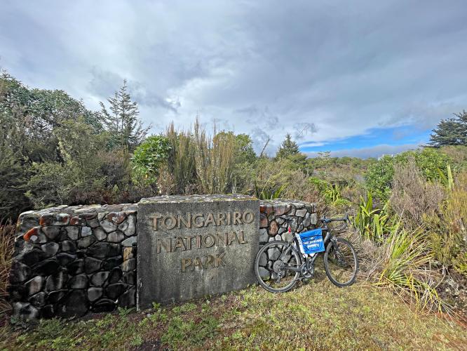
bike parked at signs at the entrance of Tongariro National Park, climb start

Climb begins at the entrance to Tongariro National Park.

Tongariro National Park was established in 1887 and is New Zealand’s oldest national park (it is also the world’s sixth oldest national park).  The park is 79,500 hectares (196,448 acres).

Climb summary by PJAMM’s Brad Butterfield.

What a sight the mountain ahead is as you climb toward the ski area. The landscape has a high-tundra feel to it, with not many trees to speak of. Once on the upper part of the climb, the road cuts through jagged volcanic rock. Ruapehu last erupted in 2007. It is a beautiful drive out to this climb and is quite far from any major towns. You can bet on having the road to yourself. I saw no other cyclists and only a few cars on my day on the climb in May 2022.

photo collage shows aerial drone pictures of the roadway up the mountain, and photos of the mountain tundra in front of you as you climb toward it

aerial drone view of three hairpin curves on route

The road is generally straight except for three brief hairpins sections.  

photo collage shows straight portions of roadway throughout climb

photo collage shows Chateau Tongariro

Chateau Tongariro located at kilometer 6.

Chateau Tongariro (aka Grand Chateau) is a magnificent hotel on the way up to the ski resort.  The hotel opened in 1929.

aerial drone view of lava fields on climb

At roughly kilometer 10 we enter and remain in lava fields to the climb finish.

views of Mount Ruapehu leading up to the volcano

Mount Ruapehu as viewed at kilometers 4-5.

Mount Ruapehu is the largest active volcano in New Zealand and is the highest point on New Zealand’s Northern Island. 

climb finish, Whakapapa Ski Area

Finish at Whakapapa Ski Area.