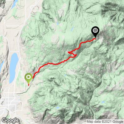
21.4
PDI
10.7 mi
DISTANCE
3,590 ft
GAINED
6.4 %
AVG. GRADE
FULL CLIMB STATS
INTRO
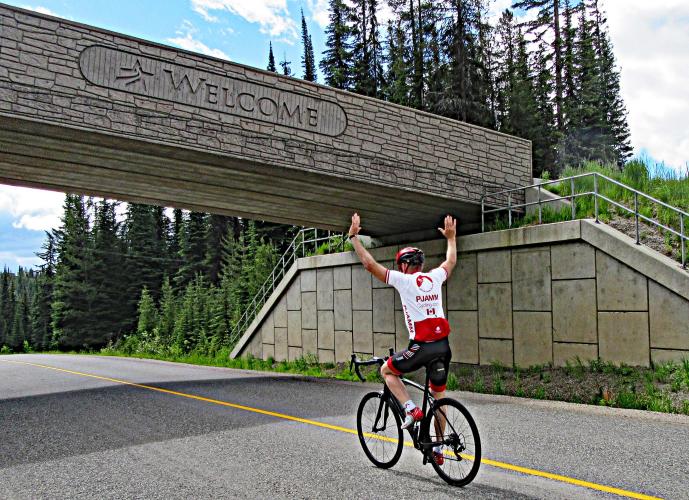
The #4 ranked climb in Canada begins in Vernon, BC and ends just short of the Silver Star Ski Resort (the main Strava segment ends near the resort itself, but this is after a kilometer of descent). The first 6 kilometers/3.6 miles are in more of a rural residential area, while the final two-thirds of the climb are in a very rural setting with some nice views down and across Vernon to Swan Lake.
PLAN YOUR ROUTE
6.4% average grade with 59% at 5-10% grade and 10% at 10-15%. The steepest 500 meter segment is 10.8% and steepest kilometer is 9.5%
See more details and tools regarding this climb's grade via the “Profile Tool” button.
Roadway: Two lane paved roadway with center stripe in good condition, and a shoulder to ride in if need be for portions of the climb.
Traffic: There is mild-moderate traffic for the first few kilometers of the ride, but minimal over the last majority of the route - this climb dead ends at a ski resort, so there is no through traffic and thus mild traffic.
Parking: On weekends and off hours - BX Elementary School 350 meters before the climb start - Map; Street View.
Provisions: None on the route but plenty in Vernon just southwest of where we begin the climb, or possibly at Silver Star Mountain Resort at the finish.
Before heading out on any cycling adventure check out our Things to Bring on a Cycling Trip and use our interactive check list to ensure you don't forget anything.
Check out this Trip Advisor page for things to do in Vernon.
ROUTE MAP
MEMBER RATING
CURRENT WEATHER
PJAMM TRIPS ADVENTURE STARTER BUNDLES
Check out PJAMM Adventure's prepackaged (self-guided) cycling trips. They will help you plan, document and conquer your next adventure.
NEARBY CLIMBS (0) RADIAL PROXIMITY
FROM No Climbs Found
MEMBER REVIEWS & COMMENTS
Let us know what you thought of this climb. Signup for our FREE membership to write a review or post a comment.
Already have an account?
LOG IN HERE