![]()
Cycling Dyers Pass West
Ride 7.9 kilometers gaining 407 meters at 4.9% average grade.
![]()
Climb summary by PJAMM’s Brad Butterfield.
Starting just outside of the heart of downtown Christchurch, the climb branches off of a main throughway near a small park. For a few kilometers the climb rises up past high end homes. It is not strictly residential, however. Riders will climb through one small village with a cafe and some boutique-type stores. Traffic can be expected to be mild to steady on the lower slopes before climbing out of the developed section of the mountain.
![]()
Climb begins in Christchurch
![]()
Highly rated Sign of the Takahe restaurant as on route just outside Christchurch
![]()
The upper portion of the road is magnificently constructed on the sheer side of the mountain, offering unbeatable views of Christchurch below. Steady grades and a mostly straight road bring you up to the summit of the ‘pass’ itself. There is a really unique cafe on your right side, which is well worth a visit for a coffee - but not yet. The climb continues left onto a more narrow road absent of a guardrail and of most traffic as well. The only cars up on that portion of the road will be fellow outdoors people - hikers, bikers, etc. The summit of our climb is relatively nondescript but can be marked by a small pond on your left as you ride.
![]()
![]()
![]()
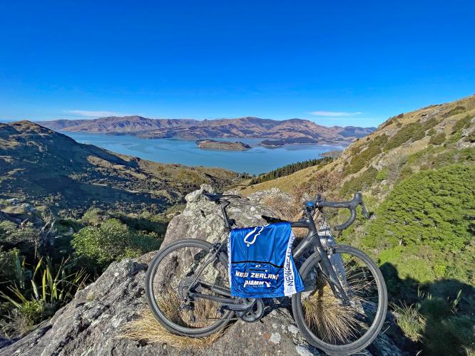
I highly recommend a short and ‘technically’ off limit hike to the rocky ridge on the right side of the road. There is a barbed wire fence you’ll need to navigate, but it is clear others have had the same idea so the barbed wire is pushed down in some parts. The view from the rocky ridge is well worth the small detour.
![]()
Views of Governor’s Bay and Otamahua Quail Island near the top of the climb.
![]()

 We've partnered with Sherpa-Map.com to bring you the best route planning tool. With a PRO Membership you can use this climb as a reference when creating your route.

