![Cycling Dyers Pass East, New Zealand panoramic view of roadway with guardrail, overlooking mountain terrain with Governor’s Bay on Banks Peninsula in far distance]()
Cycling Dyers Pass East, New Zealand
Ride 5 kilometers gaining 453 meters at 9.2% average grade.
![Cycling Dyers Pass East, New Zealand photo collage shows street sign for Dyers pass, aerial drone views showing roadway with Governor's Bay, Banks Peninsula]()
This climb begins at Governors Bay on Banks Peninsula near the head of Lyttelton Harbor. We have spectacular views of the Bay to the east as we climb.
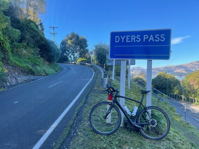
![Cycling Dyers Pass East, New Zealand street sign at climb's start: Christchurch via Dyers Pass, Dyers Pass, Diamond Harbour Akoroa]()
Start the climb at the intersection of Governors Bay and Main Roads and Dyers Pass Road.
![Cycling Dyers Pass East, New Zealand aerial drone views of Governors Bay, and roadway through mountains]()
Climb summary by PJAMM Cycling’s Brad Butterfield.
You're on the edge of the world as you start this climb! That’s no exaggeration! Steep grades shoot up from the port city of Governors Bay. Beyond the bay lies the great South Pacific ocean for endless miles. There will most definitely be traffic, as the pass is an important access to and from the bay for locals, but they all drive slowly and respectfully.
![Cycling Dyers Pass East, New Zealand bike parked on roadside, grassy country hillsides, satellite antenna at climb's finish in distance]()
With pristine road quality and a view of the bay for much of the climb, it’s one of those summits where you’ll have to pinch yourself -- is this real life, or is this fantasy?! It really is that amazing. A couple of sharp switchbacks take you to the cafe perched on the saddle of the pass.
![Cycling Dyers Pass East, New Zealand photo collage shows aerial drone views of the three hairpin turns on the climb]()
Three hairpins on the climb.
![Cycling Dyers Pass East, New Zealand front of the Kiwi Cafe at km 2.8]()
Sign of the Kiwi Cafe at kilometer 2.8.
At the intersection of Summit Road and Dyers Pass Road.
Here, turn right onto the same narrow access road the Western Pass climbs. Instead of following the access road to the same summit point marked on the Dyer Pass West route, optionally follow the very narrow road up to the radio tower. Be warned though, it is marked as a Private Road and warns of a 24 hour surveillance, however I didn’t have an issue on the day I rode.
![Cycling Dyers Pass East, New Zealand bike parked at gateway entrance to Thomson Scenic Reserve]()
Note: There are signs saying the road is closed. Ride at your own risk.
![Cycling Dyers Pass East, New Zealand sign reads "Private Property No Entry Authorised Persons Only 24/7 Monitored Surveillance"]()
900 meters at 10.3% to the top after turning off Dyers Pass Road.
While the road is marked “Private Property,” we had no problems riding to the top. Thirty-eight Strava members had done our full route as of May 2022 (240 had done the final push to the top - Strava). Input from Strava segment riders:
“Hi John, I would say not officially as technically a private access road for utility vehicle access to Sugarloaf transmitter station. In reality I have never met a vehicle/worker up there and there are also legitimate hiking trails which access the top, so public access not illegal, just vehicle access. So up to you, maybe include a disclaimer that top section from Sugarloaf carpark not a public road.”
“Hi John Johnson, people commonly walk or ride to the summit. Closed to cars.”
The views are certainly worth the risk, but it is a risk no doubt. This descent is particularly fun with the soft blue bay in view.
![Cycling Dyers Pass East, New Zealand aerial drone views show the summit of the climb, Sugarloaf transmitter station]()
Views of the top of the climb.

 We've partnered with Sherpa-Map.com to bring you the best route planning tool. With a PRO Membership you can use this climb as a reference when creating your route.

