6.9
PDI
1.5 mi
DISTANCE
812 ft
GAINED
10.7 %
AVG. GRADE
FULL CLIMB STATS
Page Contributor(s): Dan Razum, San Jose, CA
INTRO
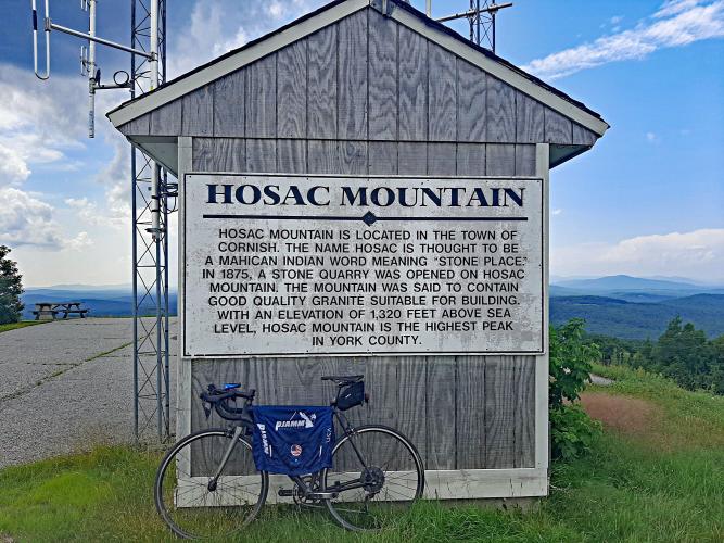
This 1.5 mile bike climb is located in ME, USA. The average gradient is 10.7% and there is a total elevation gain of 812 ft, finishing at 1,312 ft.
Use the profile tool, route map, and weather forecast to conquer this cycling climb.
Use the profile tool, route map, and weather forecast to conquer this cycling climb.
PLAN YOUR ROUTE
See more details and tools regarding this climb's grade via our interactive Profile Tool.
Information Not Available
If you have any information regarding this climb, we'd like to hear from you. Click the CONTRIBUTE button to share your thoughts with us.
Information Not Available
If you have any information regarding this climb, we'd like to hear from you. Click the CONTRIBUTE button to share your thoughts with us.
Before heading out on any cycling adventure check out our Things to Bring on a Cycling Trip and use our interactive check list to ensure you don't forget anything.
Information Not Available
If you have any information regarding this climb, we'd like to hear from you. Click the CONTRIBUTE button to share your thoughts with us.
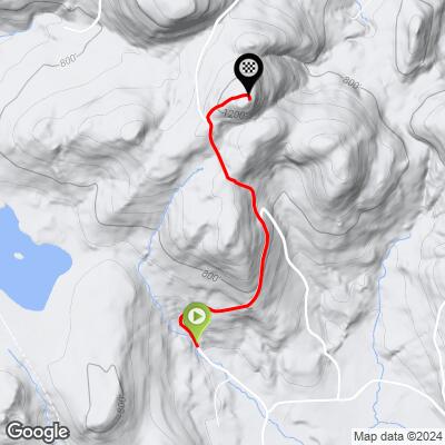
ROUTE MAP
MEMBER RATING
CURRENT WEATHER
PJAMM TRIPS ADVENTURE STARTER BUNDLES
Check out PJAMM Adventure's prepackaged (self-guided) cycling trips. They will help you plan, document and conquer your next adventure.
NEARBY CLIMBS (0) RADIAL PROXIMITY
FROM No Climbs Found
MEMBER REVIEWS & COMMENTS
Let us know what you thought of this climb. Signup for our FREE membership to write a review or post a comment.
Already have an account?
LOG IN HERE
Mikey62481
This climb is short but extremely steep at times…the hardest section is after the descent after the first mile and it feels like 20% for a good stretch, in fact for like 15-20 feet I think it's over 25%! Zero traffic on this one, it says it's a quarry blasting zone but was completely empty on a Saturday…In fact I only encountered one single person hiking the whole time…Descent is a little treacherous coming down the steep section near the top. The Views at the top are great; Tough little climb!
NOTE: next time I will park on quarry road before the route begins, as it looked like there was a place for cars to park off the road to the right side…